| 760 | Montgomery Bell Trail West Loop |
2013-01-21 |
A few weeks back we updated the Montgomery Bell Map, but did so without hiking the Montgomery Bell Trail. We wanted to visit the Park, but had other obligations and had to postpone our hike. Sunday, we finally made the visit. It was a near perfect day under bright skies.
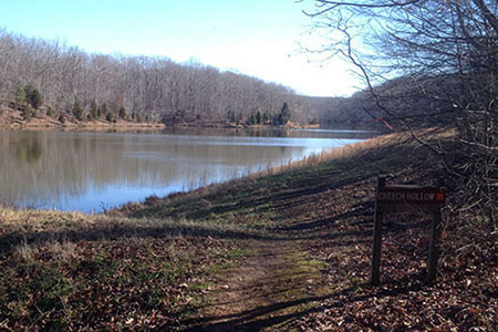
Parking at the Maintenance Office (overnight parking), we crossed Hall Creek and followed the Montgomery Bell Trail (M Bell Trail) to the junction with the Creech Hollow Trail. Creech Hollow is one of our favorite sections of the Park's trails. The trail divides the M Bell Trail into the east loop and the west loop. We were hiking the west loop.
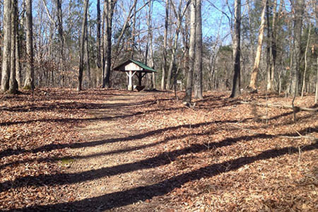
Leaving Creech Hollow Lake, we arrived at a junction with the M Bell Trail. We turned right and joined the trail. After a steady climb we crossed Jackson Hill Road and continued to the junction with the Woodland Shelter.
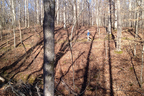
Continuing on the M Bell Trail, we climbed from one hollow to the ridge and then descended to a scenic point at Lake Woodhaven. Leaving the Lake it was a short hike to the Hall Spring and Shelter.
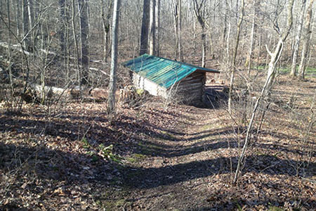
From the Hall Shelter we joined an old road as we hiked by the Hall Cemetery and a day shelter before descending to Jackson Hollow and the McAdow Cabin area. Before reaching the Cabin, we left the
M Bell Trail and joined (to the right) the Ore Pits Trail as it climbed a hill to good views (in the winter) of the old settlement. On the other side of the hill we rejoined the M Bell Trail and finished the loop at the Maintenance Parking. It was a good hike.
A few trail notes ...
From our house near the center of Nashville, it was 35 miles to the Park.
All of the trails were in good condition.
We saw about ten hikers on the trails.
Our dog, Jake, was with us. He had recently injured a front leg and was hobbled a bit. We left him in the vehicle with inside curtains drawn while we hiked. As we left, he pressed his nose against the glass cried to us in disbelief. After the hike we went to Acorn Lake and let him swim. He soon forgot being left on the hike!
We used the cloudhiking map (on an iPhone) on the hike. At each intersection we stopped and checked the distances for the next sections.
Our total distance was 6.2 miles. We tried to keep a good pace on the trail and finished the hike in about 2 hours. But, we knew, we had a dog waiting on us.
Happy M Bell trails
Montgomery Bell State Park (State Park's site)
A visit to Montgomery Bell State Park (Nov '09)
cloudhiking's Montgomery Bell State Park Map and Adventure Guide. The map is on page two.