992 - Summer Stories - A Privy Puzzle - 2016-09-15
On our summer trip to the mountains, my wife had a scheduled interruption as she attended a convention in Denver, while I stayed in the mountains with our pup, Augie Dog.
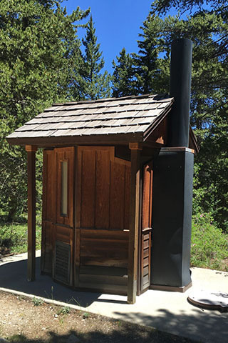
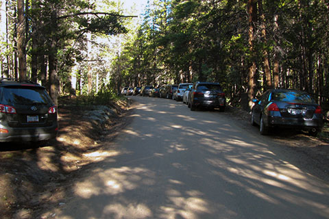
From the campground where we were staying an access trail connected to the Continental Divide Trail (CDT). Augie and I woke on our first day and headed for a leg stretcher on the CDT. On our return to the campsite I noticed a woman outside one of the campground privies. The privy was designed with a rustic look to fit better in the campground setting. As she circled the hexagon shaped facility she seemed a bit anxious.
Looking at me she said, "you don't know how to get in there do you?"
Naturally, I thought, why not try ...
991 - Chickasaw Map and Guide - 2016-01-25
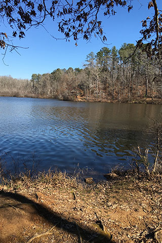 Chickasaw State Park is a small park located south of Jackson, TN in Henderson, TN. The centerpiece of the Park is Lake Placid. The lake offers fishing, boat rentals, swimming, and a great trail (Lake Shore Trail). Along the shores of the lake are cabins, swimming area, recreation area (volleyball, basketball, playground, ...), Group Lodge, Sagamore Lodge, picnic shelters, restrooms, restaurant, campgrounds, stables, and trails.
The trails at Chickasaw are not long or difficult, but they are still entertaining. Though the Lake Shore Trail is the ...
990 - Hickory Ridge and River Trail - 2015-11-21
 While looking at maps I recently noted some inconsistencies with our map (cloudhiking.com's map) of Henry Horton State Park (near Chapel Hill, TN) and Google Maps screen view of the area. Simply put, Google Maps seemed to have had more current data than we had on the cloudhiking map.
A couple of years ago, we made a map of Henry Horton State Park. The map focused on the main area of the Park and more specifically it was for a cross-country running course. While making the map we included the major Park features but did not address the trails north of the Duck River. Recently while working on an update to the cloudhiking map, we checked the area on Google Map. It was then we noticed trail lines that were not on the cloudhiking map. Hmmm, that called for a road ...
989 - Everyone is Doing It - part 2 - 2015-10-09
 Everyone really is doing it. Climbing, hiking, scrambling, backpacking, mountain biking, trail running, mountaineering, kayaking, rafting, etc, are no longer extreme sports exercised by a few highly skilled elitist, now outdoor sports are popular.
On a summer visit to Colorado we stay
at Elbert Creek Campground, near the trailhead of the highest peak in CO. We saw everyone doing it on Mount Elbert. In fact, climbing or rather hiking up mountains is so popular in Colorado that Fourteener (mountains above 14,000 feet) was chosen as the unique Colorado word by Yahoo. We visited the area on a late July weekend with the rare predication of zero percent chance of afternoon thunderstorms. Everyone came to the mountain, they all wanted to do it.
During our stay we spoke with the campground host on ...
988 - Everyone is Doing It, part 1 - 2015-09-24
 We have visited Half Moon Creek area quite a few times through the years but have never camped there. A fairly descent dirt road (Half Moon Rd) leads to access points for Mount Elbert (the highest peak in CO) and Mount Massive (the second highest peak).
On a Friday in July, we we drove down Half Moon Road looking for a place to camp. Dispersed camping sites lined the road, but we wanted a bit more than that, we needed a site where we could get a good night's sleep. The dispersed sites were not defined or governed and a car load of loudness could arrive in the middle of the night and camp just feet away from your tent. Looking for a better solution, we entered Elbert Creek Campground which is across the road from Mount Elbert Trailhead. We had recently had some bad luck with finding camp sites and were not confident that we would find a spot, but as we entered the campground, the first site we saw was open. It was large, close to the water pump and trash dumpster, and not far from the privy. The drawbacks were ...
987 - Wind Rivers - Day 5 - 2015-09-02
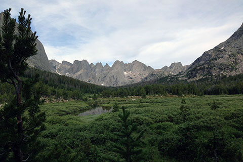 Day 5 was going to be our last day of backpacking in the Wind River Range of Wyoming. We started the morning enjoying our five star campsite in Lizard Head Meadows. There was no rush on the final day, as we were only climbing over one pass and hiking a moderate distance.
Breaking camp, we even took the time to air out the damp items from our packs and the camping gear that was exposed to the night's moisture. It was comforting to our shoulders to think our packs would not be stuffed with wet gear. After multiple cups of coffee, we finally put away the stove and mugs and shouldered ...
986 - Winds - Days 3 and 4 - 2015-08-18
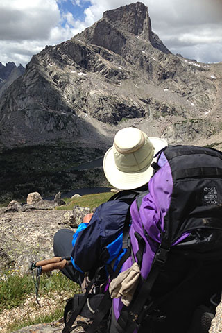 Day 3 started cool and fresh. From our camp we had a good view to the north and could see weather moving west to east across the range. We were sure glad we were south of the stormy weather.
Being our third day on the trail, we had perfected our packing techniques and smoothly transitioned from camp to trail with a bit of breakfast thrown down to satisfy our hunger.
Rejoining the trail we were just a short walk to Washakie Creek. Boulders and rocks gave us a fun route across the creek without getting wet. There were good campsites (better than our last site) close to the crossing.
The weather was staying to the ...