| 990 | Henry Horton State Park Hickory Ridge Trail & Wilhoite River Trail |
2015-11-21 |
While looking at maps I recently noted some inconsistencies with our map (cloudhiking.com's map) of Henry Horton State Park (near Chapel Hill, TN) and Google Maps screen view of the area. Simply put, Google Maps seemed to have had more current data than we had on the cloudhiking map.
A couple of years ago, we made a map of Henry Horton State Park. The map focused on the main area of the Park and more specifically it was for a cross-country running course. While making the map we included the major Park features but did not address the trails north of the Duck River. Recently while working on an update to the cloudhiking map, we checked the area on Google Map. It was then we noticed trail lines that were not on the cloudhiking map. Hmmm, that called for a road trip! We needed to walk the trails.
A few trail notes ...
We parked at the Camp Store near the Campground.
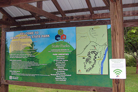
A good map is available at HHSPHealth.com.
The Hickory Ridge Trail starts near the Camp Store, crosses River Road and enters another parking area or alternate trailhead.
The Hickory Ridge Trail has an Inner and Outer Loop.
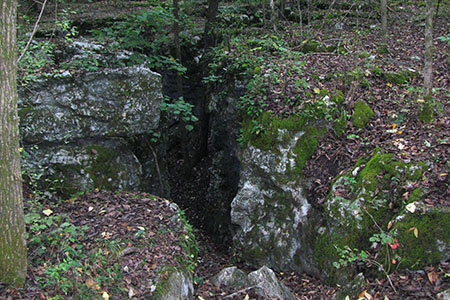
The Hickory Ridge Trail winds through sink holes and passes through cedar glades. It is a fun hike, especially the Inner Loop section, which has more sinks.
Along the southern leg of the Outer Loop Hickory Ridge Trail, a connector trail heads south, crosses River Road, and joins the Adeline Wilhoite River Trail.
The Wilhoite River Trail actually starts at the trailhead east of Hwy 31 at the Duck River bridge and heads west following the river, then leaves the river and to make a loop. We joined the trail at the northern most point of the loop.
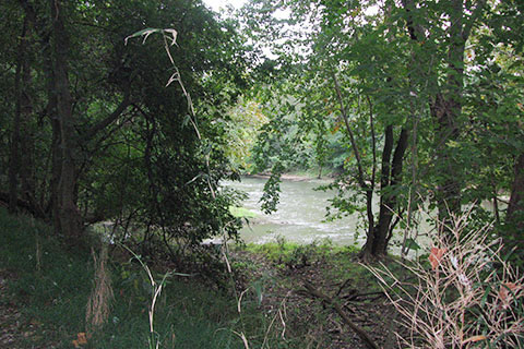
We hiked the eastern leg of the River Trail loop first. The trail followed and crossed several fence lines in a gentle descent to the river. After arriving at the Duck River, we went upstream for a distance and then returned to the junction with the loop. We continued downstream to finish the loop.
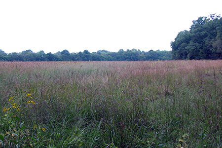
We left the Duck River as the River Trail entered the corner of a large native grass field.
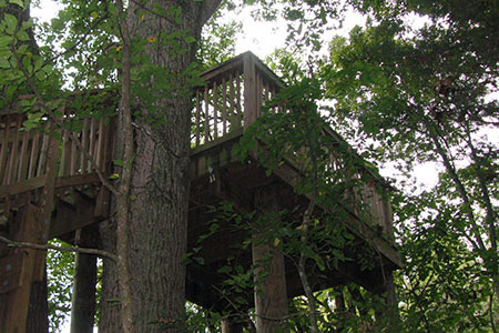
An observation tower was built in the trees near the field. What a great structure for viewing the birds and wildlife in the field.
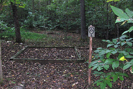
Leaving the observation tower, we climbed a steep section of trail to reach the crest of a ridge. Three backcountry campsites were located on the ridge above the observation tower. The climb to the ridge was the only steep section of the hike and it was short.
Finishing the loop we returned to the Hickory Ridge Trail by the Connector and continued the Outer Loop/Inner Loop combo around to return to the trailhead.
Back at the trailhead by the Camp Store we decided to walk the River Trail along the Duck River to connect to the loop we had just hiked.
We walked through the Campground Tent Loop to reach the Wilhoite River Trail.
Where we joined the trail was the Duck River Blue Trail take out point - a designated boat route. The launch point is upstream 1 mile in the Henry Horton Picnic Area.
Heading west along the river, the trail parallels the river for a good distance with faint side trails crossing to the Campground RV Loop.
Restrooms and water are available in the Campground. The Tent Loop restroom was most accessible.
Continuing east, the trail continues to the Wilhoite Mill Trailhead at Hwy 31. It was a fun hike along the river with many access points to the river's edge. Highlights of the trail were several footbridges and exposed tree roots and rock formations exposed by the Duck River in flood stage.
The trails are well signed and marked.
An interesting loop of the trails could be made by parking at the Camp Store, hiking the Hickory Ridge Trail to the Connector Trail, then south to the loop section of the Wilhoite River Trail. Hike the western section of the loop and when reaching the Duck River continue east (upstream) on the River Trail to return to the Campground. Walk through the Campground to return to the Camp Store.
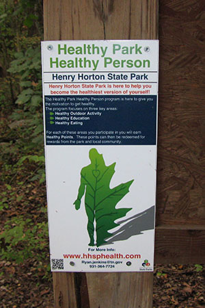
Henry Horton has a 'healthy heart, healthy person' program. It would be great to see similar programs in all of the State Parks!
Happy Henry Horton trails