| 987 | Wind Rivers Day 5 |
2015-09-02 |
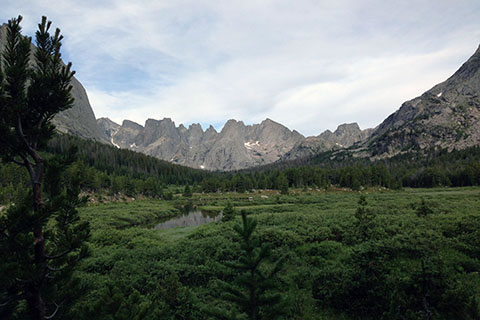
Cirque of the Towers from Lizard Head Meadow
Day 5 was going to be our last day of backpacking in the Wind River Range of Wyoming. We started the morning enjoying our five star campsite in Lizard Head Meadows. There was no rush on the final day, as we were only climbing over one pass and hiking a moderate distance.
Breaking camp, we even took the time to air out the damp items from our packs and the camping gear that was exposed to the night's moisture. It was comforting to our shoulders to think our packs would not be stuffed with wet gear. After multiple cups of coffee, we finally put away the stove and mugs and shouldered our loads.
Yes, this was the trail...
Hiking away from our campsite in the Meadow we had outstanding views of Pingora and the Cirque of the Towers. The trail was easy but due to the recent heavy rainfall, sections of the path actually looked more similar to a creek bed. Soon, we saw other campers in the region, but the area was not crowded.
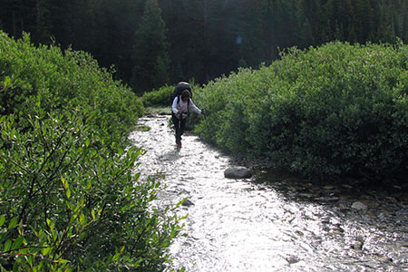
After about two miles we reached the shores of Lonesome Lake. We stopped to take a few photos and then looked for a dry route for crossing the swollen outlet. A few boulder hops and we were on the south bank. Augie, the pup, also boulder hopped. This was surprising to us as we thought he would just jump in the water instead. Good boy!
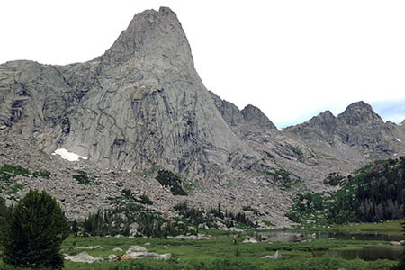
Pingora Peak towering above Lonesome Lake
There is no camping within a quarter of a mile of Lonesome Lake. We did see a couple of fishermen, but that was about all. As we walked around the lake I recognized places where I had camped - many, many years ago. We never did see an official Lake sign or trail.
At the far end of the lake we turned away from Pingora and climbed toward Warbonnet and Jackass Pass. Following climbers trails that mostly led to the Cirque, we pieced together a route toward the pass. We knew we were not on the official trail, somewhere it had turned away from the lakeshore without us. Without referring to a map or the GPS, we climbed toward the pass.
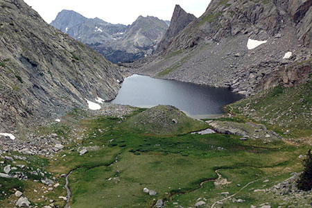
Arrowhead Lake and the unofficial trail
At the true pass (the low point) between Mount Mitchell and Warbonnet, we looked to the northeast and could see Jackass Pass. I thought Amy would have enjoyed a photo of the colorfully named pass, but it was at least a 120' higher in elevation. We did contour across the slope on a worn path to intersect the path as it descended. Many other hikers had also chosen our route. Another trail (the one we should have taken) crossed a creek and climbed high onto Mount Mitchell's shoulder. We looked at the path, without checking the maps, and decided to descend on a great trail toward Arrowhead Lake instead.
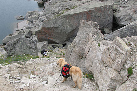
Augie looking down on Amy along the steep path
At the Lake's shore, we were stopped by a large unfamiliar boulderfield. It had been years since I had been to the area, and I did not remember the trail, but I was pretty sure, we were not on it. We still decided to continue. Amy and I thought we would be able to cross the boulders, but we were not sure about Augie. Rather than risk injuring the pup, we climbed a steep slope along the edge of the boulders to near the pass we had just crossed! At the top of the boulderfield at base of the wall (which probably calved the boulders), we found easy passage across the boulders and regained a path around the lake.
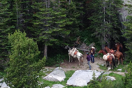
Horse packers
We continued on the path as it crossed the outlet and descended to the main path north of North Lake. The trail descended to the feeder, North Creek, and then climbed above the lake and weaved through the rocky terrain. At the south end of North Lake, the trail descended to cross the outlet. A horse packer was near the creek crossing. The crossing was the end of the trail for the horses, above that point the route was too technical for safe passage.
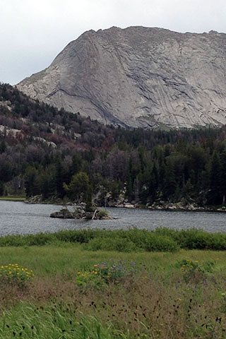
Big Sandy Lake
The trail crossed meadows and descended to Big Sandy Lake. At the lake we saw a few other hikers, but still it was not crowded. Leaving the lake we just put our throttles on cruise control and enjoyed the mostly pleasant hike along the Big Sandy River to return to the trailhead. We did meet several very large groups heading up the trail. Big Sandy Lake was going to soon be very crowded! We were glad we were not staying the night.
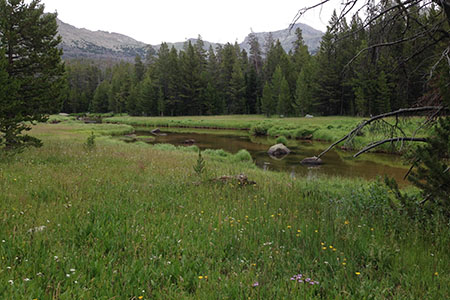
Big Sandy River
On our short trip, the good days were almost perfect, but the cold rainy days were in turn apretty tough. The Winds gave us adventure and a good dose of wilderness, that will call us back for more. As soon as we returned to the trailhead, we began planning our next trip to the Winds.
Happy Wind River trails
Days 1 & 2
Days 3 & 4