| 838 | Tetons - Grand Teton Loop Jenny Lake to Death Canyon - Valley Trail |
2013-07-28 |

Continued from Sunset Lake to Jenny Lake
After our big day and light supper, we hoped we would have the energy to walk the next day. We did wake early and were a bit surprised that we were actually ready to walk. We still had a few last minute packing decisions to make and then we were ready to go.
Shortly after starting, we passed a young deer eating in a meadow near Jenny Lake. The deer barely acknowledged our existence as we continued. He just ate and we just took a couple of photos and smiled.
The Valley Trail is marked on a sign at a junction on the south side of the Jenny Lake Trail, but any of the trails or roads that lead south from Jenny Lake to Lupine Meadows Road would have worked equally. The key is to get from Jenny Lake to Lupine Meadows Trailhead.

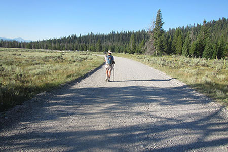
Dusty Lupine Meadows Road
After 1.65 miles (from our campsite) the trail we followed joined Lupine Meadows Rd and we continued along the road for .50 mile to the trailhead. The road was dusty and boring to walk.
We passed through the parking area and continued up the very familiar Amphitheater Lake Trail. Bears notoriously hang out near trail above the creek crossing, but we did not see any on this hike.
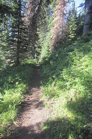
At the Valley Trail Junction we took the Valley Trail south. Finally, we were on a new trail. From the long switchbacks of the upper Lupine Meadows, we had seen the Valley Trail far below, now we were able to see the switchbacks high above us.

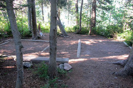
The Backcountry Campsite at Bradley Lake
The Valley Trail from our campsite at Jenny Lake to the junction to Bradley Lake was easy. It was mostly level or even downhill. As we neared the lake we descended only moderately. On the north shore of the lake we stopped at the Bradley Lake Campsite that is designated for the Loop Trail. What a great place to stay.
After going around Bradley Lake, we then climbed to a ridge separating Bradley and Taggart Lakes. Descending, we passed a large boulder. The same marmots we had seen when we walked the Bradley - Taggart Trails the week before were still hanging out on the same boulder and seemed to be posing for passers by.
At the south end of Taggart Lake we filtered water and then continued to the Valley Trail - Beaver Trail Junction. It was a sunny day and the temperature was rising, but it was not that bad.
From that junction it was less than four miles to Death Canyon. We were moving strongly, but we were still cautious because of the heat.
The last section of trail seemed rather boring even though it was new to us. We crossed several creeks and meadows which were the highlights of that section of trail. We saw no other hikers on the trail and sections were overgrown. We decided that not many folks walked this section of the loop.
Mileage signs along the trail confused us. The signs gave the distance to Whitegrass Trailhead. We were not really sure exactly where the Whitegrass Trailhead was but several times before we had driven past and seen what we assumed was the Whitegrass Ranch. As we neared the road, we began searching for the ranch and trailhead. We thought the Whitegrass Trailhead was different than the Death Canyon Trailhead.

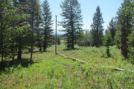
Utility Pole near Whitegrass Ranch
As we continued, we saw a pump-house and a power-line (and utility poles) but that was about all. There was no signage to Whitegrass. Hmm. We don't understand why the signs directed hikers to Whitegrass; instead, just go to the junction with the Death Canyon Trail.
Amy finally declared that she could see people ahead (it had been awhile, there was really no one on this section of the trail). It was but a short climb to the Death Canyon Trail and down to the parking area.
We had completed the Grand Teton Loop. Our mileage for the day was 11.25 miles (from our campsite) and our overall mileage was 37.30. The Loop Trail is one of our favorite trails of all times. It is a great hike and needs to be on your to do list!
Happy Grand Teton Loop - Part Three - trails
Grand Teton National Park - Backcountry Camping
cloudhiking's Adventure Guide and Map