| 836 | Tetons - Grand Teton Loop |
2013-07-25 |

While planning our summer trip, one of our goals was to hike the Grand Teton Loop. The hike was going to be about 35 miles. Our plan was to hike the loop as two consecutive day hikes.
After securing a campsite at Jenny Lake (tent only and very hard to acquire one of the 50 sites) we wanted to use our Jenny Lake campsite for the overnight between the two day hikes. The campsites have bear boxes. We would store all of our food and cooking gear in the bear box and all of our other essentials in the tent, then drive to the Death Canyon Trailhead to start the hike. Day one would be about 25 miles. We would hike from Death Canyon, climbing to Static Pass, then descending to the west side of the Tetons before climbing again to Hurricane Pass. Continuing we would descend to the south fork of Cascade Canyon and return to our Jenny Lake campsite. We would not have a vehicle for the night, but we wouldn't need one either. The next morning we would walk the 10 miles to return to Death Canyon, finish the loop and return to the vehicle.
We thought we had a good plan. Twice before, we had hiked the Paintbrush Canyon Loop as a day hike and it was about 24 miles, a similar hike as the long day of the Grand Teton Loop. Reading a guidebook the author warned about starting at Death Canyon, but we thought that advice would pertain more to backpacking the loop.
Checking the weather we chose a day for the hike with zero percent chance of rain! We went to bed early and got up at 0430 to be ready to start the hike by 0600. We were concerned about the heat on a long day.
The Death Canyon Trail ascends to Phelps Lake overlook and then descends to the inlet creek and the base of Death Canyon. The descent was easy, but we know from experience the south facing slope is very hot in the afternoon especially when returning to the Death Canyon Trailhead.

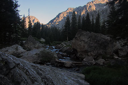
Death Canyon in the early morning
Climbing Death Canyon was not overly difficult. It was early in the hike. We slowed the pace a bit and cruised to the upper canyon. It is 3.8 miles to the trail junction near the patrol cabin. We filtered water near the junction.
At the junction in Death Canyon, we began climbing on the Alaska Basin Trail. The trail climbs through long switchbacks to a nice saddle between Albright Peak and a couple of smaller bumps. It is about 2.6 miles and 1850 feet elevation gain from the trail junction. Ouch! But at least we made it before the sun hit the slopes.
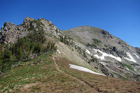
From the shoulder the trail passes the bumps on the left side as it climbs gradually. Another saddle is reached and then the trail begins climbing in earnest up the rocky, exposed slope to Static Pass. It is about 1.6 miles from the first saddle to the Pass and a climb of another 1000 feet as the elevation is close to 11,000 feet.

Nearing Static Pass with Buck Mountain in the background
From the Pass, the trail crosses over into the Alaska Basin. For us the Pass was a decision point. We would assess the weather as well as our own conditions and decide whether to go on with the Loop or return to the trailhead. After a brief conversation we continued.

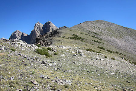
The trail contours to the right and crosses the ridge at the long thin snowfield guarding the ridge
As we started into the Basin, the views in all directions were amazing. After climbing to the Static Pass, the trail in the Basin was easy. The trail basically descends to Sunset Lake.
We saw a large group approaching from a distance. When we finally met, we discovered they were a group of youth trail crew volunteers. On their off day, they were hiking to Static Peak.
The trail rolled along in the Alaska Basin crossing into the Jedediah Smith Wilderness and the Targhee National Forest. The Forest Service trails were not as manicured as the National Park trails but they were still easy to follow.
After descending to 9600 feet we reached the beautiful, Sunset Lake. It was 3.80 miles from Static Pass and about 11.8 miles from the Death Canyon Trailhead. Many hikers camp in the vicinity of the lake. The National Forest does not currently require a permit for camping, but all camps must be at least 200 feet from water or the trail.

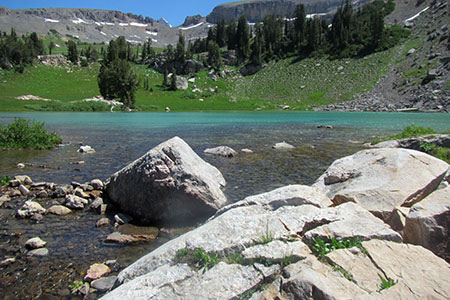
Sunset Lake
Sunset Lake looked magical. It had deep green hues under the blue skies. We couldn't believe the National Parks didn't try to extend their boundary to include the lake. Of course, the National Forest probably wouldn't like that one bit!
The lake was the end of the descent and the start of the climb to Hurricane Pass. The first half of the Grand Teton Loop was amazing to us. What we didn't know - the views maybe got even better!
Happy Grand Teton Loop - Part One - trails
Grand Teton National Park - Backcountry Camping
cloudhiking's Adventure Guide and Map