| 316 | Hiking Skills - The Ten Essentials - Navigation | 2010-12-06 |
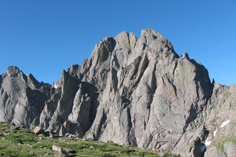
A few years back, we were in Colorado climbing Kit Carson and Challenger Point from South Colony Lakes. It was a big day with many miles of trail-less travel. On our return from the summits we had to re-cross numerous ridges and smaller peaks. Crestone Peak dominated our view. Our camp was near it's base.
Descending one of the ridges, we were talking mindlessly as we followed worn trail like sections. I looked up and was unfamiliar with what I saw. This was only the second time I had ever been to Kit Carson and the fourth time to the Crestones, so I was not intimate with my surroundings; but I new Crestone Peak should be a big part of my view. The problem was we were looking down into a beautiful valley, the Peak was not to be seen. We stopped and discussed what was happening. Pulling out the GPS we determined that we were very close to being on track (following the track we had made when we climbed the ridge). So, why couldn't we see the huge Crestone Peak? Changing gear, we pulled out a map and quickly oriented it. Getting an elevation reading from the GPS, we made a fast plot of our position.
We were not lost, I had followed a climber's or goat's trail to the wrong side of the ridge. Crestone Peak was hidden from our view; but our correct route was less than fifty feet away.
We quickly made the course correction and merrily skipped back to camp! Well, or at least, we dragged our tired bodies back to camp. The whole "misplaced" incident lasted only a minute; but it made us re-focus on our route finding. Navigation is important - it is essential. good navigation skills keeps us from having to use many of the other essentials stored inside our packs.
The old ten essentials only called for a map and compass; but the updated list includes the GPS. I used to carry an altimeter with me to supplement the map and compass, now I carry a GPS instead. The GPS is a great tool; but a map and compass are still critical.
A few navigation tips...
- Keep track of where you are. Check the map at each easy fix location. A fix is a known point. Where the trail intersects another trail is an easy fix. It is easily located on the map.
- When you look at the map orient (or turn) it so that your view matches what is on the map.
- It is generally easier to see the big picture on a map.
- The GPS will always show you where you are within a few feet. The GPS can be confusing to read.
- A watch is also a key navigation tool. It allows you to know how fast you are moving and when you should arrive at the next fixed location.
- A writing utensil is also important. Make marks on your map. They will help you remember where you are. Every time I do not carry a pencil with me, I wish that I did.
- If you find yourself misplaced stop and think it over. Get out the guidebook, map, compass, GPS, etc. If you are hiking with someone else discuss the concerns.
- If there are trails, stay on them. Shortcuts are hardly ever, truly shorter.
I carry a map and compass with me on almost every hike and carry a GPS on every hike. If I am familiar with an area, the map is still helpful to share with other hikers.
Navigation is a skill. It takes practice to use a map and compass and other navigation devices such as a GPS and altimeter. The skill to use the equipment is as essential as the equipment itself.
We use...
Garmin 60CSX GPS (replaced by the 62)
Brunton Compass
National Geographics - Trails Illustrated Maps
USGS Maps
Brunton Altimeter
Most of the navigation items mentioned are available from our affiliates' sites in the right sidebar.
Happy I know where I am trails.
Links to Essentials

click and buy, help support our site