
| 795 | Eagles Point Overnight Trail Map and Guide |
2013-04-12 |
Two weeks ago we visited Mousetail Landing State Park. We are happy to announce that the Map and Guide are now up on cloudhiking.com.
We had never been to the Park and so we wanted to explore as well as hike the two major trails. On arriving we drove to the Park Office to check on current information. Trail information was available on a kiosk in front of the Park Office.
We were planning to day hike the trail, so we did not need to register. Carrying light packs we left the trailhead at 1000. It was a great hike. The trail was easy to follow and at a moderate grade. We walked at a steady pace and arrived at Shelter 2 in less than an hour. Continuing we were at Shelter 1 at 1200 and back at the trailhead at about 1315 (one-fifteen).
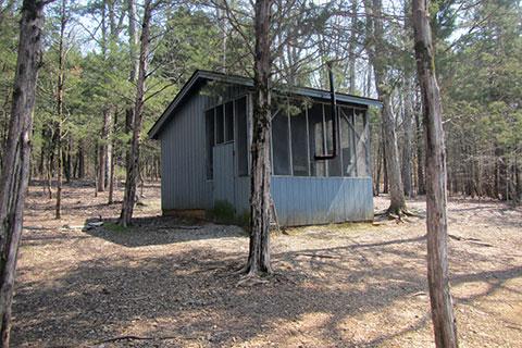
Highlights of the Overnight Trail were the shelters, the view from Shelter 2, the lesser used Shelter 1, the trail from Kelly Creek to Sparks Ridge, and the trail along the ridge from Shelter 1 to the trail split at the beginning of the loop. If you are confused, check out the map on cloudhiking.com.
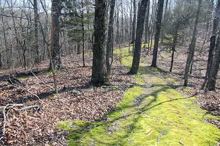
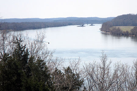
After our big hike, we planned to walk the shorter, Scenic View Trail. Starting at the Park Office the trail climbs a moderate grade to a ridge. We followed the ridge to join Sparks Ridge and took a spur trail to the Campground. Returning to the main trail we walked down Sparks Ridge to the Pavilion. Perhaps our biggest highlight of the visit was this section of the trail. Most of the vegetation along the trail was dormant and still brown, except for the path itself. The path was covered in a thick carpet of bright green moss. What was really amazing was the moss covered the trail for about a half of a mile. The beauty of the trail was not in the 'scenic views' of the river (there really weren't any), but instead the lush carpeted path.
After returning to the Park Office, we allowed Jake to swim in one of the inlets. The swim was his highlight of the trip. Woof!!!
Leaving the Park we wanted to find the Primitive Campground separated from the Main Park by an inlet. Spring Creek Campground was not what I would call a primitive area. Each site had camp pads, tables, and fire rings. Some of the sites even had pull-thru access for smaller trailers. The campground's primitive rating was because the sites did not have running water or electricity. What the campground does have, is location. The sites are on the shore of the embayment! I am sure the sites are in high demand during the warmer months.
The last highlight we saw as we were driving home. Our return trip, we passed through Linden, TN. As we neared the town, there was a sign - Perry County, Gateway to Fun. Well, we did have a lot of fun that day. The sign just topped it off.
If you have a chance, please visit cloudhiking.com and check out the new pages. Then, plan a trip to Mousetail Landing and Perry County - the Gateway to Fun!
Happy Mousetail Map and Guide trails