| 790 | Mousetail Landing Overnight Trail |
2013-04-01 |

Last year, a frequent user of cloudhiking suggested that we visit Mousetail Landing near Linden, TN and hike the Overnight Trail. Along with the recommendation he sent his GPS track. To be honest, I did not know exactly where Mousetail Landing was, but if the trail was as good as his other suggestions, we needed to make a visit.
It took almost a year before we started looking for the Park, but last week we finally found it. Yes, AC, it was a worthy trail.
Amy had her spring break last week so we had the whole week to play, but the weather was not cooperating. As we were trying to choose a good weather day for the hike, we frequently checked the online weather forecasts and changed our plans almost daily. We decided to go on Friday, then Saturday, and finally at the last moment decided to go on Thursday. It was going to be the best weather day.
Mousetail Landing is a relatively new park, 1979, on the banks of the Tennessee River. When we entered the Park we drove to the Park Office, but it was closed. An information kiosk had a map and trail information, including registration forms for overnight visits.
After the brief stop at the Office we drove the roads to the Pavilion and then to the ridgetop campground. The Park is relatively small, so it only took a few minutes for the tour. Returning to the Office area, we parked near the trailhead and began our hike.
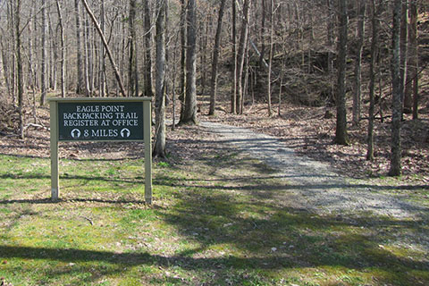
The trail is a lollipop. You hike to a loop, hike the loop, and then return.

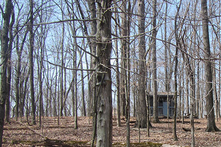
Shelter 1
A few trail notes ...
The trailhead was near a playground. The Park has water and restrooms, but not at the trailhead.
Registration is required for overnight users only.
Dogs are allowed on the trail but must be on a leash (and under control).
The Park is located on the Western Highland Rim. The hills were not overly difficult, but we were not carrying heavy packs.
While crossing the fields (at the bottom of hollows), the grass was soggy - it was springtime.
It seemed as if someone had blown the leaves off sections of the trail. The bare trail were very easy to follow.
On the section of the trail between the shelters, the leaves had not been removed.
The trail was marked with trail signs and blazes. Blue blazes marked the Overnight Trail.
Green and yellow blazes marked the mountain bike trails. The green blazed trail crossed the hiking trail many times.
The distance from the trailhead to the loop was about 2 miles.
From the loop junction, it was .75 mile to Shelter 2 and 1.25 miles to Shelter 1. It was almost 2.50 miles distance between the shelters.
Our total (raw) distance for the trail was 8.5 miles - plus the short visits to the shelters.
Both shelters have bunk beds for 8 with a dirt floor. The shelters are screened and have indoor wood stoves. The flue pipe on Shelter 1 was damaged.
Outside each shelter was a fire ring, picnic table, and trash can. The trash cans were empty - we assumed the cans were being checked regularly.
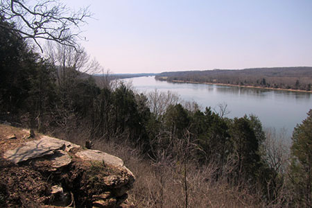
Shelter 2 had a nice view of the Tennessee River.
The noise from the boats on the river might be annoying.
Neither shelter had a nearby water source. I guess you could get water from the river, but I would probably treat (add iodine) the water, filter it, and maybe boil it!
The shelters are good rest stops whether you are overnighting or not.
There was no litter on the trail, but some trash around the shelters.
Always practice minimum impact hiking and camping.

View from Shelter 2
We had a great day at Mousetail Landing. The Overnight Trail was a good day hike or would be a good short overnight adventure.
A map is sure to follow!
Happy Mousetail trails