| 678 | Mount Ida | 2012-07-15 |

Since coming to Colorado, the weather has been very hot and very dry. Everyday another wildfire was started and older fires were still raging. The area needed water.
After we climbed Mummy Mountain, the rains came - lots of rain. The next five days were rainy. Where wildfires were, now flooding and landslides were the issues.
While the much needed water quenched the thirst of the dry land, we spent most of our time out of the mountains. Finally, the forecast called for only a chance of showers and we planned a hike.

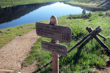
Trailhead sign, the mileage to Mount Ida is 5.0 miles not 4.0
Starting from Milner Pass, our destination was Mount Ida, four miles to the south. Arriving at the trailhead at a leisurely 8 (it was a long, slow drive), there were already a few hikers who had started hiking before us.
The trail begins on the Ute Trail (linking Milner Pass to the Alpine Visitor Center on Trail Ridge Road - four miles away). From the trailhead the trail goes a partial way around Poudre Lake and then makes one switchback to great views of the lake. Once entering the trees, the trail begins to climb steeply. A junction is reached a mile from the trailhead. At the junction a sign was posted to warn hikers of the difficulties of cross-country navigation.
The path to Mount Ida begins at the junction. The trail is unimproved, but it is mostly a distinct path that follows along the west side of the Continental Divide to the base of the final slope leading to the summit of Mount Ida.

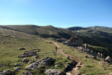
Mount Ida is the bump in the distance
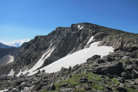
Nearing Point 12150, the path climbs steeply again before it passes the summit a few hundred feet below. At a small saddle between Point 12150 and Mount Ida, the path ends. Rock cairns (stacked rocks) attempt to mark the way to the summit. The markers are often times hard to find. Some hikers find navigation in boulder or scree fields difficult, but the key direction to remember is to go up until the summit. Near the top is a steeper rise and the summit is reached at 12889 feet. There are great panorama views from the top.
A few trail notes ...
There are privies at the trailhead, but no water.
The trail sign at the trailhead incorrectly indicates the distance to Mount Ida as 4.0 miles. It is 5 miles to the summit of Ida from Milner Pass.
Beware of the weather. Being on the Continental Divide, it is easy to see clouds approaching. Turn around in threatening weather.
Cairns are built by hikers to help mark their way - sort of like a trail of bread crumbs. The small rock markers are not permanent. They do get knocked over by weather, animals, and other hikers. Do not solely rely on cairns as waypoints. Hopefully, the cairns will lead to where you are going, but they might also lead to a good place to use as a restroom, instead of the summit. You don't know why they were built and where they lead. Use good navigation skills to find your destination - cairns are just an aid to navigation.
As you hike turn, to see what the return hike should look like.
We saw big horn sheep and elk on our hike.
Mount Ida is a popular hike for a good reason. Once above treeline, the path travels for three miles (one way) across alpine tundra with great views in all directions.
Happy Mount Ida trails