| 583 | Virgin Falls Map and Guide |
2012-02-21 |
On cloudhiking.com, we have just finished the Virgin Falls Map and Adventure Guide.
Virgin Falls is located on the Cumberland Plateau southeast of Sparta, TN. The area was originally set aside as a Pocket Wilderness and was later designated as a State Natural Area.
The 1157 acre Natural Area is home to numerous waterfalls including the namesake, Virgin Falls. The stream for this unique waterfall comes from a cave, then it pours over a cliff and then disappears as it returns to the earth through a sinkhole. It is like watching a faucet turned open and the water just pouring down the drain. It is amazing.
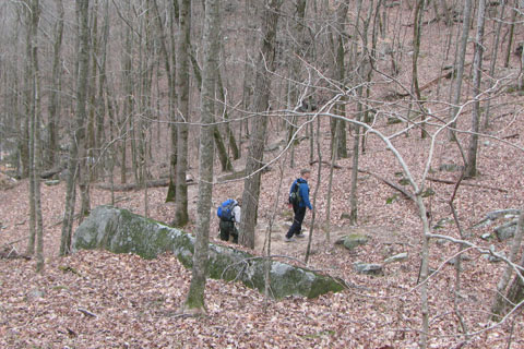
Access to the Falls is made by a good trail. It is mostly downhill to the falls and mostly uphill to return. The round trip mileage is 8.2 miles. The trail can be either an overnight trip or day hike. There are four designated campsites in the area.
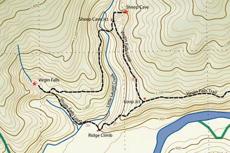
The Adventure Guide covers the main trail to Virgin Falls, the side trail to Sheep Cave, and the side trail to the Overlook. Included in the Guide are pictures from our hike. On Page 2 of the Guide are the Notes from the area (which help you prepare for your hike), a mileage chart, and links to GPS tracklogs and a PDF map of the area. The map was designed for use on a smart phone such as an iPhone. It may be printed; but if you have a smart phone, why not save a piece of paper.
Remember Virgin Falls is a protected Natural Area. The pristine nature of the environment can be easily damaged. Please tread lightly and follow all of the Leave No Trace Principles.
Happy map and guide of the trails