| 575 | Virgin Falls Part 2 |
2012-02-09 |
Virgin Falls - Part 1 (from 2012-02-06)
Now for a few notes on Virgin Falls ...
The parking area at the trailhead is fairly large; but the area sees a lot of traffic.
There are no restrooms or water at the trailhead.
The elevation at the Parking Area is 1750 feet. The lowest point of the trail, just below Virgin Falls near Piney Creek, is 900 feet.
Hiking to Virgin Falls is quite easy; but the hike out is uphill. :-)
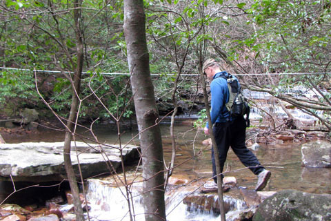
When we visited the area, the streams were full. The crossing were not too difficult; but they could be tough with an extra foot in their banks.
The trail made a couple of unplanned crossings (using logs, etc) of the Big Branch drainage. The creek wandered through a low area. The water would only be present in the rainy season.
When crossing the creek with the cable, stay on the downstream side of the cable.
The cable crossing is over Laurel Creek, not Big Branch.
The trail was well marked with freshly painted blazes.
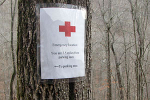
There have been some issues with hikers getting lost in the area.
To aid in navigation, temporary signs have been posted every half mile, giving directions, and the new trail blazes clearly mark the path.
The temporary signs are marked with red crosses.
Remember, Virgin Falls is a Natural Area in a wilderness setting. Users have to exercise good judgement and common sense to safely visit the area.
The markings along the creek indicate a boundary. The land on the other side of the boundary is managed by the TWRA (TN Wildlife). I am assuming the boundary is clearly marked to prevent users, such as hunters, from accidently crossing into the Natural Area.
There are four campsites in the area. My friend, Robin, pointed out, that most Natural Areas do not allow camping. The first, campsite is at Laurel Creek, about 1.5 miles from the trailhead.
The other campsites are at the Overlook (reached by a side trail), Big Laurel Falls, and Virgin Falls.
When we hiked, there was no litter on the trail, other than at the camping areas.
If you carry a heavy pack to the Falls, you are in for a gruelling hike to return to the trailhead. Pack your pack with care.
There was a Leave No Trace principles document at the trailhead.
The side trails to the Overlook and Sheep Cave were worth the extra effort.
No official trails go to the top of Virgin Falls.
Use care and good judgement at all water crossings and on top of all cliffs.
Directional Sign
Enjoy the area; but tread lightly and Leave No Trace.
Happy Virgin Falls - Part 2 - trails
Virgin Falls Natural Area (Official Page)