| 570 | Trillium Gap Trail Part 2 |
2012-02-02 |

Trillium Gap Trail - Part 1 (from 2012-01-31)
Now for a few notes on the Trillium Gap Trail ...
We started the Trillium Gap Trail from the lower Rainbow Falls Trailhead (Cherokee Orchard).
There were nice privies at the trailhead; but no water.
The parking area was overflowing by the time we returned to the area in the afternoon.
The trailhead did not have a map or trail kiosk.
Leaving the trailhead the Rainbow Falls Trail was not well marked.
The Connector Trail followed close to the road(s) until reaching the Trillium Gap Trailhead parking.
We were able to see the Trillium parking area from the Connector Trail. Oddly enough it was then a good distance before we reached the junction with the Trillium Gap Trail.
It was .2 of a mile on the Trillium Gap Trail from the Trillium parking area to the junction with the Connector Trail. (We walked from the junction to the parking area - just to check it out, and then returned.)
Our distance to the junction with the Trillium Gap Trail from the Rainbow Falls trailhead was 2.45 miles.
We both felt that the Connector Trail had sections that were steeper and more sustained climbs than any of the climbs on the Trillium Gap Trail.
The Trillium Gap parking area, also, had privies. There were no cars parked at the trailhead.
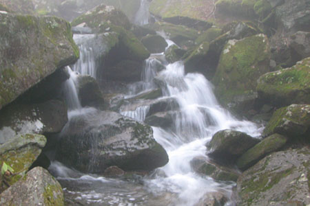
From the junction it was 1.25 miles to Grotto Falls. We loved walking behind the falls.
Between Grotto Falls and Trillium Gap we met a hiker coming down the trail. He tried to discourage us from going toward the summit. We had a brief conversation and continued on our way.
Okay, the hiker was right. The weather was bad on the top, as he warned. We continued because we had gear to at least help us endure the cold, experience to overcome any difficulties, and our agenda was just to hike the Trillium Gap Trail. We were not planning on hanging out at the top.
From Grotto Falls it was 1.65 miles to Trillium Gap. In the spring, Trillium Gap is supposed to be full of wildflowers, they were not in bloom, yet.
From Trillium Gap to the top of LeConte there were several downed trees. Some of the trees were huge and made passing them difficult.
The downed trees slowed us quite a bit.
Ice on the trail also slowed our pace.
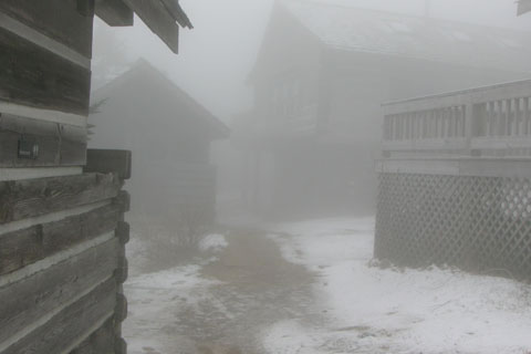
When we reached the Lodge at 6360' we were in a whiteout. We heard hikers walking around the cabins; but couldn't see them.
From Trillium Gap we measured 3.55 miles to the Lodge.
We were cold within a few minutes of stopping near the Lodge, so we started back down the mountain via Rainbow Falls Trail. Oh, we were wearing all of our clothing, it was just cold on top.
Five hikers walked by us while we stopped to eat lunch. Two hikers who came up Alum Cave Trail did not seem to have any additional clothing and they were noticeably cold. The high summits in the Smokies may be cold any time of the year and are generally cold in the winter months.
After descending to Rainbow Falls, we began meeting other hikers and walkers.
The lower section of the Rainbow Falls Trail was in bad condition from overuse. There were so many trails it was often times hard to find the official trail. The Park Service does not use trail blazes as markers. Practically every curve in the trail had a shortcut. The trail needs a lot of work and the users need to be educated.
There was not a lot of litter.
After completing all of the trails on LeConte, our favorite trails (in order) are: Alum Cave, Boulevard, Bull Head, Rainbow Falls, and finally Trillium Gap.
Trillium Gap was the easiest trail.
Our total mileage for the day was 15.75 miles.

Climbing LeConte by any trail is a good adventure. Make sure you put one or two routes on your to do list.
Happy LeConte trails