| 521 | Short Springs Natural Area |
2011-11-22 |
Machine Falls
Last weekend we went for a day hike to Short Springs Natural Area. Short Springs is located between Manchester and Tullahoma on Normandy Lake. A couple of months ago, we visited Old Stone Fort in Manchester and while researching the area we saw Short Springs. Then, a hiker from town, who has kindly shared GPS and photos with me, said that he had visited and recommended Short Springs. On our next available date, we made the short trip from Nashville to the Natural Area.
Before our trip we had never been to Short Springs or even the general area. We used Google Maps for general directions, but did not print a map (mistake 1). Then, we discovered that Amy left her phone at home (mistake 2). The next thing you know we are touring mid-Tennessee - we misread (mistake 3) the directions and ended up in Tullahoma. Backtracking we did not want to return to Interstate 24 to start over; but we did not have a map and we had no directions from Tullahoma. We took out Amy's GPS; but soon saw that it did not have a map for the area (mistake 4). It was still loaded with the Colorado map! Finally, we found Short Springs. It was on a back road that seemed to lead to elsewhere from nowhere. Oh, an interesting note, the parking area is adjacent to a huge water tower with Short Springs State Natural Area painted on the tank/reservoir in big letters - we just didn't see it.
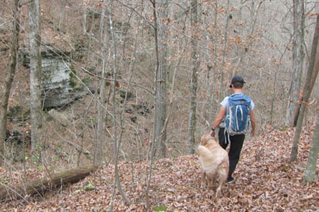
Crossing the road from the parking area, we began our hike. At a trail junction with a bench and kiosk we took the blue blazed, Busby Falls Loop Trail to Bobo Creek. After letting Jake, the dog, play in Bobo Creek we crossed the creek and hiked the Laurel Bluff Loop. The trail offered great views of Bobo Creek and a couple of springs.
Returning to Bobo Creek, we continued on the Busby Loop to a junction with Machine Loop. We returned to the original Junction on the white blazed, Machine Loop Trail (to the bench and kiosk) and then reversed our path. (We try to close all the loops for map making purposes.)
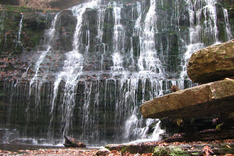
Machine Loop strolls across a ridge easily until shortly after the red, Connector Trail. the Machine Loop then drops steeply to Machine Falls Branch. The steps drop to the creek bed. A short Wildflower Trail goes to the left and along Bobo Creek for a short ways. Another spur leads to Machine Falls. Use care walking on the narrow rock ledges to the bottom of the falls. It is quite spectacular.
We continued on the Machine Falls Loop and then took the orange blazed, Adams Falls Loop. The trail was scenic but Adams Creek was dry. There was a small spring however just below the falls.
Returning to the Machine Loop we returned via the white blazes to return to the parking area. Our total distance was 5.75 miles, but we backtracked a couple of times and also explored a bit.
A few trail notes ...
There were no restrooms or water.
A kiosk was available at the trailhead and at the first trail junction.
A few benches were dispersed along the Machine Falls Loop.
We did not see any litter.
The leaves were deep (in the fall).
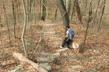
At times the trails were difficult to follow (leaves); but they were well blazed. Jake, the dog, had no trouble showing us where to go.
Trekking poles would have been helpful in the deep leaves.
We saw one family hiking the trails. A small child was wearing a green cape and rubber fireman boots. The dad said they made him faster. Flash!
We enjoyed the hike. The area reminded us of Beaman Park. It was a good adventure.
Happy Short Springs Trails