| 484 | Old Stone Fort, Again | 2011-09-27 |
A few weeks ago we visited Old Stone Fort State Park in Manchester, TN. On the trip we recorded the trails using GPS and took pictures along the trails. Some of the data did not quite match and I had to return to the Park to make sure of a few things. When you are making maps and guides, as we do on cloudhiking, we try very hard to be accurate. If there is an error, hopefully it is from the interpretation of the data, instead of the collection of data.
On the return trip I went alone. I hiked the Wall Trail (or Old Stone Fort Trail), then the Wall Trail again; but this time with the Optional Trails, the old farm road that goes around the Enclosure's field, and finally the Garrison Road Loop - located near the campground.
Well, I still had fun. I hiked on Sunday morning and did not see anyone else on the trails. I was alone. The Wall Trail and Wall with the Optional Trails were quick because I had hiked them on our other visit.
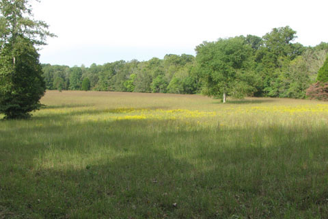
While I was hiking the Wall Trail I saw a bench on the old farm road in the Enclosure. The old road was being used as a walking path also. I was not intending to walk it; but since I was there ... why not? See notes below.
Leaving the main area around the Enclosure, I went to the campground, crossing the one lane bridge, to hike the Garrison Road Loop. It was a well marked and easy to follow trail. The noise from Hwy 41 was loud; but Old Stone Fort is within Manchester's City Limits. It was still a good hike.
A few trail notes ...
Enclosure old farm road
There were no signs or directional posts along the old farm road.
On our visit a few weeks back, I saw folks walking the road.
I think walkers use the road or parts of it to access different areas of the Park, instead of the Wall Trail.
To find the road, walk through the entrance mounds and into the field. Do not go left, as you do to access the Wall Trail. After a short distance you will see the start/finish of the loop. Go left and follow the road. Do not follow any trail signs (they are all meant for the Wall (or Old Stone Fort) trails, just stay on the road.
The clay was slick.
There was a bench.
The loop of the road was exactly one mile. It was a very easy path.
Garrison Road Loop Trail
The trail seemed designed for use by the campers. There was no designated parking in the area.
The signage said that the trail was .6 miles; but my GPS said .8 miles and my watch agreed.
The path was easy; but did have a short but moderate climb and a set of steps to descend.
There were many directional posts.
It was interesting to see the remains of the old Hwy 41.
Happy Old Stone Fort trails, again
Original Old Stone Fort Journal entry
TN State - Old Stone Fort