| 798 | Cross Country Route Montgomery Bell State Park |
2013-04-19 |
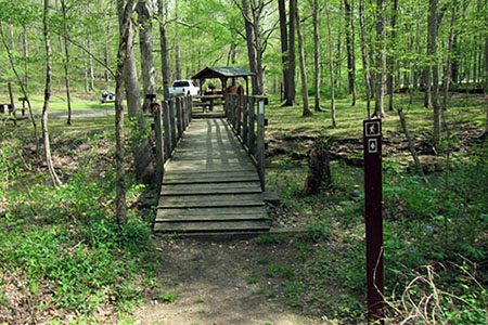
Crossing Hall Creek
Last week I visited Cedars of Lebanon State Park to collect data from a new cross country trail. Oh, the map is complete, except for a few tweaks, at least, the last that I heard. It should be posted soon. Then, this week I visited Montgomery Bell for another cross country route.
Montgomery Bell is a great hiker's park. They have great trails that are well maintained. Any reason to visit the Park is a good one. I was not meeting anyone at the Park on this trip. I was going to walk the route alone and was able to first obtain a GPS track. For fun, I loaded the route onto a geo-referenced map and then onto my iPhone. I was able to check the accuracy of the map as well as the route as I walked. Okay, not everyone might think that would be fun, but to me it was tantalizing! Yes, my wife, Amy has to put up with this all of the time.
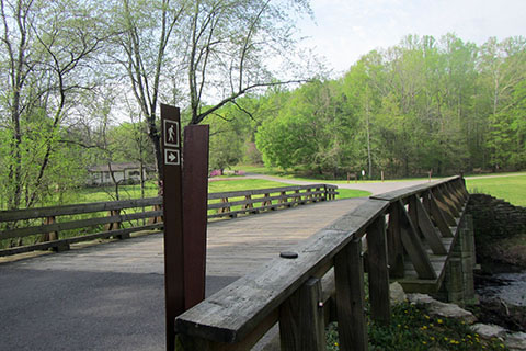
The course starts in a field along Hall Creek near the campground dump station, which is just beyond the ball-field. A hiking pictograph on a brown background and brown marker post marks the route.
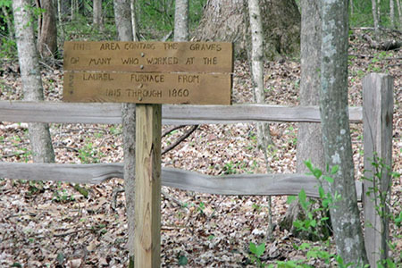
Cemetery the runners pass while climbing the hill
From the starting line, the route crosses a field and joins the road at the bridge. At the road junction, the route follows Group Camp 1 Rd all the way to the entrance of Group Camp 1. Runners go left at the junction and climb a 100 foot (elevation gain) hill. Along the way they will go through the gate (used to secure the group camp area), cross the Montgomery Bell Trail, pass an old cemetery, and finally reach the top of the hill. The course continues along the road to the entrance to the group camp which is almost a half of a mile from the top of the hill.
Mile 1 marker on the dirt road
Near the entrance to the camp, signs lead to the right to a dirt road. The pleasant path passes the 1 mile sign and reaches the turn around point - .20 mile from the paved road. Naturally, runners will return the .20 mile back to the paved road. Once back on the Group Camp 1 Road, return .30 mile to the start of a field on the left. The markers lead away from the road (oops, I turned here when I passed the turn on the way to Group Camp 1, sensing the turn was too early, I pulled out my iPhone and saw the route went straight - the route turns on the returning leg.)
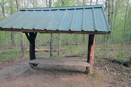
Day Shelter on the Iron Ore Loop Trail
The trail follows a mowed path along the edge of the woods. After .20 mile, the route approaches the back of a day shelter located on the Iron Ore Trail. Now, the fun begins ...
Bridge at the bottom of the hill, the route goes to the right of the shelter
Turn right at the trail junction and follow the hiking trail as it reaches the Montgomery Bell Trail (MBT) after a little more than .15 mile. Going left at the junction with the MBT, it is all downhill to a bridge at a picnic shelter. The trail passes the picnic shelter on the right and joins the road. It is about a tenth of a mile to the Group Camp 1 Rd junction and another tenth to the finish line.
A few notes ...
The running course would also make a good walk.
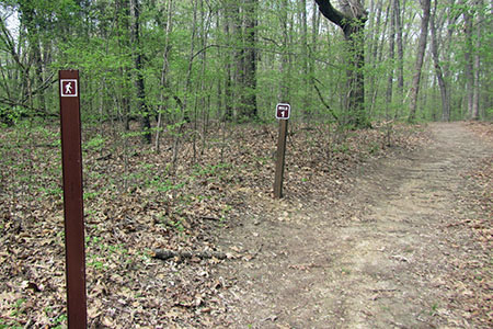
Route markers are hikers on a brown background. The Park uses round, metal hiker pictographs as their trail markers. Where the trails overlap, both the brown course markers and the Park's trail markers line the course.
Climbing the first hill will be tough, but after the hill, the course is easy.
cloudhiking's current Park Map will be updated (shortly) to include the running route.
There was only one place that the route was confusing, as indicated above. You do not turn off the road until you can see Group Camp 1. The other turn, at the field - is made on the return leg of the road. Perhaps the course setters will add an arrow or another marker to help.
Once at the day shelter, the trail goes downhill. Use care while running this section.
Water and restrooms are available near the campground.
The cross country route should make a fun run!
Montgomery Bell has many trails to hike, run, walk, or stroll. The cross country route is a good example of linking existing roads, dirt roads, paths and trails. All the trails are good, if they motivate us to keep moving.
Happy Montgomery Bell XC trails