| 214 | Devil’s Backbone | 2010-04-12 |
"Governor Phil Bredesen has proclaimed April 5–11 Tennessee State Natural Areas Week."
To help celebrate State Natural Areas Week, we chose to hike at Devil’s Backbone State Natural Area on Saturday. The trailhead is located on Natchez Trace Parkway near mile 394.
The spring colors made the drive from Nashville spectacular. The redbuds were blossoming all along the road, framed by the spring leaves.
Many bicyclists were taking advantage of pleasant weather. In fact, they were the largest user group of road travelers. From serious riders, traveling at 20 mph, to teenagers who looked as if they could have benefited from training wheels, they lined the road near the shoulders of the road in mass.
There were also plenty of motorcyclists; but most were stopped at a pull off and not riding.
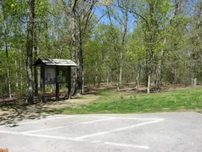
Trailhead kiosk
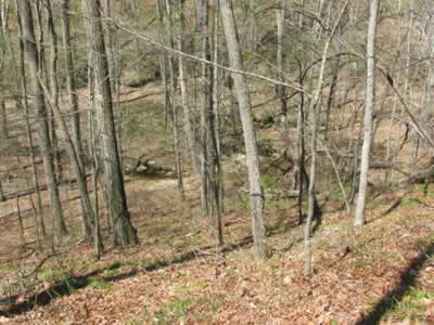
The trailhead is located on the Parkway. From the kiosk, the trail goes out a ridge for half of a mile to the beginning of the Loop. The two mile Loop continues out the ridge for a half of a mile before descending a couple of hundred feet into Spring Hollow. At the bottom of the hollow, the trail crosses the small creek a couple of times. Then after crossing an old bridge the trail meanders along the west bank of the creek before it climbs back out of the hollow. A moderate ascent reaches the ridge on the opposite side of the hollow. Once on the ridge, the trail follows an old road for a mile to return to the Loop Junction. It is a half of a mile to return to the trailhead.
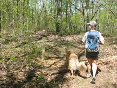
At the 2 Mile Loop
A few trail notes ...
- It was very quiet in Spring Hollow. The small creek was all that could be heard. It was very pleasant.
- On the ridges the noise from the road was constant.
- At the trailhead there were no facilities, only an information kiosk.
- The kiosk gave helpful information.
- There were no maps available. We didn’t need a map, but there was an empty map holder on the kiosk.
- The trail was mostly easy to follow. The one exception was at the first creek crossing. A separate trail had been recently made to avoid the crossing (?). We wandered following the new trail for a minute until we saw a blaze on the trail we had just passed. We turned around and crossed the creek at the original crossing.
- At important trail junctions there were signs.
- We saw three other people walking the trail.
- The trail was in good shape.
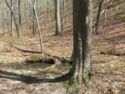
Looking back at the creek crossing, there were no blazes
on the opposite side of the tree
Devil’s Backbone was a nice hike. We wouldn’t have called it a destination hike, due to it’s short length; but it was a good leg stretcher for anyone traveling the Parkway.
Happy Natural Area trails.

for more info ...