| 595 | Collins Gulf and More |
2012-03-08 |
Now for a few notes on Collins Gulf and the other Savage Gulf trails ...
The Savage Gulf Natural Area is part of South Cumberland State Recreation Area.
South Cumberland's headquarters is in Monteagle, TN. From the office the staff manages ten different areas and 17,000 acres. (Info from brochure)
Savage Gulf Natural Area is the largest of the areas at over 14,000 acres. The area is not developed, it is a hikers park.
Collins Gulf is one area in Savage Gulf.
We entered the Natural Area at the Stone Door Trailhead.
Stone Door Trailhead has plenty of parking, water, a picnic area, nice heated restrooms, a Ranger Station, and trail kiosk.
The road to Stone Door is gated. The gate is opened at 7 and closed at dusk.
All hikers are supposed to be off of the trails by dusk.
The trailhead also has walk-in campsites. The sites are less than a quarter of a mile from the parking area. Group sites are also available.
Self registration is required for hiking, camping, and climbing in the area.
The trails are well marked with blazes and signed at at intersections.
Stone Door is an easy one mile walk from the trailhead. It is worth the effort.
From Stone Door it is another mile (downhill) to the trail junction with the Big Creek Trail and the Connector Trail.
The Connector Trail connects to the other trails in Savage Gulf including the Stone Door Trail, Big Creek Trail, Collins Gulf, Stagecoach Road, and the North Rim and North Plateau at Hobbs Cabin.
When we hiked, all of the trails were in good condition. A recent storm had passed through the area and the water was high, but there were very few trees or limbs blocking the trail.
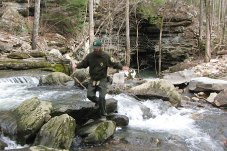
The Collins Gulf Trail made two creek crossing. We were able to cross on stones. Hiking sticks or a natural equivalent would help with the crossings. The first crossing could also be waded. The second crossing is in a cascade and it would be difficult to wade. Be aware of high water.
If you planned on using Collins Gulf Trail as part of your route, the Stagecoach Road can be used as an alternate route.
The Collins Gulf Trail did not seem to as traveled as the other trails we used.
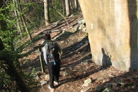
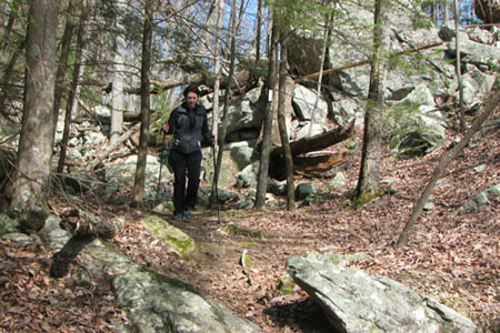
Collins Gulf was scenic and wild. The trail was at times very rocky and would be easier in sturdy shoes.
The trail also crosses several bridges.
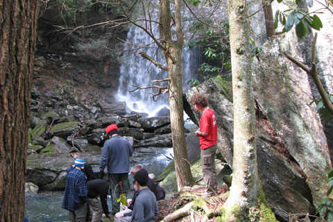
Suter Falls was big.
We met several groups during our hike. One large group (I assume Boy Scouts) was resting at the Rocky Mountain Creek bridge below Suter Falls. They looked like they were having fun.
The trail goes near a privy at Collins East Campsites.
The Collins Rim Trail was easy with plenty of overlooks.
The Old Stagecoach Road was interesting. Jason, a South Cumberland ranger, shared some history of the historic road.
Along the trails, water was everywhere. Every creek was filled. The water would need to be treated or filtered before drinking, but it was in abundance.
The trilliums were already blooming.
There is still time to sign up for the Marathon ...
A few pictures
Happy Savage Gulf trails