| 199 | Bledsoe Creek State Park | 2010-03-08 |
Saturday, Jake and I went to Bledsoe Creek State Park near Gallatin, TN for our weekly hike. The Park is located east of Gallatin on Old Hickory Lake. It is a small, 164 acre park.
I parked close to the lake, near the ball field, and started walking from there. In retrospect I could have parked anywhere and would not have been far from a trail. The trail system network makes good use of the limited acreage.
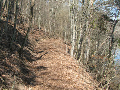
The Loop trail starts with the Shoreline Trail which naturally, follows the shore of Old Hickory Lake. It is a very easy hike and easy to follow. If you were camped at the Park, it would make a great connector linking areas of the Park. From the Wildlife Observation Deck it is about .75 miles to the camper’s boat dock and launching area.
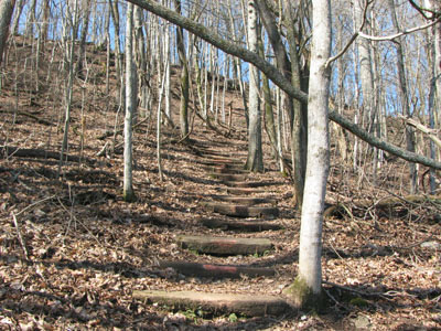
The trail crosses the parking lot and continues from two locations, not to worry, they intersect in a couple hundred feet. Leaving behind the campground the trail is more isolated as it follows the Park’s boundary. An old homestead and an old road are passed as the trail follows the shore. After half a mile the trail turns left and begins to climb to the ridge top. It is only a hundred foot ascent but it is steep enough to let you know it is there. At the top of the hill a bench awaits.
The trail rolls with the hills for the rest of the journey back to the paved Park road. From the lake it is a half of a mile to the intersection with the blue trail. Turn left on the blue trail to quit the Loop and return to the Park Road.
Continue on the Loop by going straight. At the next intersection (about a third of a mile), a trail goes down to the left to the Park Office. To complete the Loop, stay on the ridge instead. In a couple hundred feet, yet another trail goes down to the left. It too, goes to the office. Continue straight for the Loop. The trail comes to the road in a quarter of a mile.
Cross the road and continue on a now paved path. The next trail (dirt) which intersects from the right leads to the boat dock and launching facility on Zieglers Fort Road. It is a worthy a half mile addition to the trail (there and back).
Back on the Loop, in a few hundred feet the paved path returns to the ball field close to where it started. Turn right just before the Stage on a dirt path and walk along the field to return to the Observation Deck.
A few trail notes...
- I did not ask at the closed Park Office, but I was confused about trail names.
- I have four different maps, and none seem to agree. I guess when I finish the cloudhiking map, it too will differ from the others.
- The dirt trails were litter free.
- There was the customary litter washed up onto the shore from the lake. I did not see a "no littering" sign at either boat ramp.
- The paved paths which have trash cans dispersered along the way, were slightly littered. There was not a lot of litter, just candy and chewing gum wrappers (and an easy fix) but I still thought it was odd with all the trash cans around.
- It was a perfect day when we were there. The boat launches were seeing lots of traffic. I was told that the reason the State Park Boat Launches are so busy is that they do not charge a launching fee and everyone else does. I hope the users appreciate and acknowledge their free access.
- The Park did not seem ( I walked the trails but did not tour the facilities) to have a pool and did not allow swimming in the Lake.
- The trails were easy to follow, but they maybe need trail signs - the wooden type which could tell where the trail goes.
- There was a sign post on the Birdsong Trail which had a green blaze arrow pointing in each direction!
- All the facilities and the grounds were well maintained. I hate seeing litter, but that is a user problem, not maintenance.
- There was a Sheriff’s Substation in the Park.?
- A great stone fence marks the Park Boundary on the High Ridge Trail.
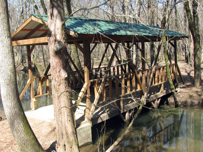
- Most of the bridges in the Park were newly constructed and were covered. I really couldn’t figure out why.
- I did not see anyone hiking on the trails (dirt). There were quite a few walkers on the paved paths (I counted 12, but could have been off by a couple.) The most walkers I saw were along the Park Road.
I was very pleased with my visit to the Park. It was small; but they probably had the highest ratio of trail mileage to acreage of any Park. Keep in mind it is not a wilderness setting, but it still is a fun place to roam.
Happy trails.