| 512 | Bells Bend Map , updated | 2011-11-08 |
Bells Bend Park was the first map we made for cloudhiking. We visited the Park, walked the trail, photographed a few key elements, and collected GPS data. At home we compiled the data and made a map and adventure guide to the area.
The kiosk map for the Park indicated one named trail, the Loop Trail, so that was the only trail we walked. Then, after talking to the Park Manager last spring, we decided to walk the other trails and update the map to add the missing trails.
Without talking to anyone from the Park, I went and hiked the trails and then completed the map update. Later as I talked to the Park Manager, she informed me that there were other trails that were not on our updated map. I humbly promised to finish the mapping in the fall.
A month or so ago, I returned to the Park and ran the trails. Then, as I prepared to update the map I found a couple of problems with my data. I tried to rationalize the inconsistencies; but ended up going back to the Park to look at it again. (Amy, my wife, thought that was just an excuse to go hiking at the Park again!)
Last week, Jake and I returned to the Park, to verify the information. We checked a couple of distances and confirmed a short section of trail. Oh, I did pick the best day of the week for the hike. There were a number of other hikers enjoying the trails. Some were serious photographers, judging from their gear. I am sure they saw that I was not a serious photographer, judging from my point-and-shoot!
Finally satisfied with the trail data, I finished the map. I am still tweaking some details before making it the default map for Bells Bend on cloudhiking. Visit the Park, but beware, you might find yourself making excuses to return for more.
A few trail tips ...
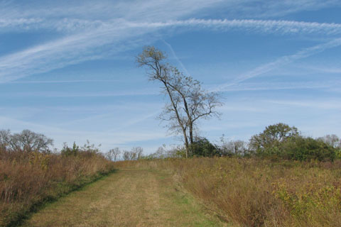
The Park looked great, as usual.
My overlooked section of trail adds 2.3 miles to the trail system. The new trail is the Dove Farm Loop.
Also look at the trails on the east side of the Park including the Buchanan House Loop Trail.
The Park has over 8 miles of trails! Some of the trails are one way and would require walking more mileage to walk all of the trails.
The map was designed for electronic viewing (computer, tablet, smart phone, etc). It does not look good printed. We are working on a printable version.
Happy updated map trails