| 354 | Mount Le Conte Trip Report | 2011-02-25 |
Sunday, February 20, I arrived at the Rainbow Falls Trailhead off Cherokee Orchard Rd in the Great Smoky Mountain National Park at about 8am Eastern. The parking lot was empty. I ate some breakfast and was on my way by 8:15. I had not hiked the Rainbow Falls Trail before and was excited to get going.
Just up from the trailhead there was an unmarked Y junction. Left looked as if it went uphill and that was the way I wanted to go. (Oh, to the right was my return route from Bull Head Trail.)
The Rainbow Falls Trail stayed close to the Le Conte Creek until reaching Rainbow Falls. Climbing at an easy grade, the trail seemed easier to me than the Alum Cave Trail. Switchbacks tamed any of the steep grades and soon I was looking at the Falls.
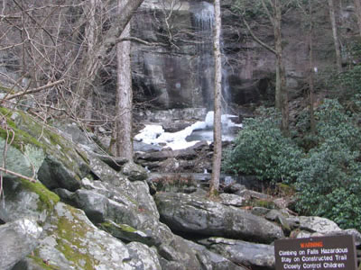
Rainbow Falls
At the Falls there was a warning sign cautioning adventurers not to climb on the rocks of the Falls. In February even coming close to the water looked cold, so I obeyed the sign and continued on my hike.
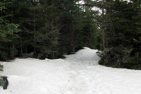
Just above the Falls the trail leaves the Le Conte Creek drainage and heads north to a ridge line. At 5400 feet the trail entered the snow. The mountain above that elevation was snowed except for exposed southern slopes.
The whole trail is shaded, with hardwoods below and evergreens on the ridges; but there were few viewpoints. At about 5.5 miles the spur trail to the Rocky Spur Overlook branches off to the left. The Overlook was really just a section of the trail with less trees and bushes. The views are good; but it is not as spectacular as Cliff Top. Continue on the Spur Trail and it will rejoin the Rainbow Falls Trail in about a quarter of a mile.
Just beyond the Spur Trail, the trail intersects Bull Head Trail. To the right leads down the mountain and to the left goes to the summit. This was the location that I found that I probably did not have any food - see Packing Mistake) Going left I headed toward the Lodge and the summit.
The snow covered trail had refrozen into a hard glazed surface. I donned a pair of boots and a pair of instep crampons and was able to walk with ease.
The Lodge was "CLOSED"; but the rest of the mountain was open (!), though cold and windy. I followed the trail to High Top, the summit, then stopped at the hiking shelter for a small rest. Without food, the stop was short. Continuing I visited Cliff Top and then started down the mountain on the Bull Head Trail.
The Pulpit on Bull Head
The snow continued on the Bull Head Trail past Balsam Point to the 5400 foot level, once again. Changing back in to running shoes I continued down the Bull Head. The Bull Head Trail might even been easier grade than Rainbow Falls. Uneventfully I reached the junction with the Sugarland Trail (gravel road).
Turning right I returned to the Cherokee Grove Rd and then right and uphill to a junction with the Rainbow Falls Trail. (Oh, this was the other leg of the Y junction that I noted was unmarked at the start.)
It was a good hike, made a bit more challenging because I did not bring food. If you plan on hiking these trails in the winter, be prepared for cold, windy conditions.
A few trail notes ...
The trail to Rainbow Falls was really worn. I am assuming it sees a lot of traffic.
When I returned to the trailhead, the parking area was full.
My round trip mileage was 15.5 determined by GPS.
There was some litter on the trail and a lot of litter at the shelter.
At the shelter there was a stack of firewood and a recent fire ring, even though a sign designating "No Fires".
I saw only a couple of hikers all day. It was cold and windy.
I had hiked the Bull Head Trail once before with my friend, Jon. We started at Sugarlands Visitor Center and climbed and descended LeConte in one big day a few years back. Re-hiking the trail reminded me of that trip.
I hated walking on the gravel road (Old Sugarland Trail) to return to the trailhead. It was easy, just a boring way to end a hike. If I ever hiked the trail again, I think I would go up Bull Head and down Rainbow Falls.
There were two bears near the trail. One snuck behind a boulder. I didn't chase him. The other bear was seen about a mile later, I startled him and he ran up a very steep slope. It was amazing to watch him move. I thought the bears were still hibernating!
Happy Le Conte trails.
