| 973 | Mount Yale Map | 2015-01-30 |
Mount Yale - Summit (05JUL14)
Mount Yale is a great Colorado 14,000' peak. Located south of Elbert and Massive, Yale lies just west of Buena Vista, CO. The trailhead is accessed by a paved road (CO Hwy 306) and a National Forest Campground (Collegiate Peaks Campground) is nearby. Wow, and if that is not enough, the large parking area is also paved with privies tucked away at one end.
However, don't be confused by the easy access into thinking that such niceties are extended throughout the route ... the trail climbs 4,296' in 4.60 miles. In order to climb at almost 1,000' per mile, the route has to go up a lot!
We have climbed the route three times and understand why it is so popular. We were excited to hike it again last summer ('14) and to now offer a Mount Yale Map.

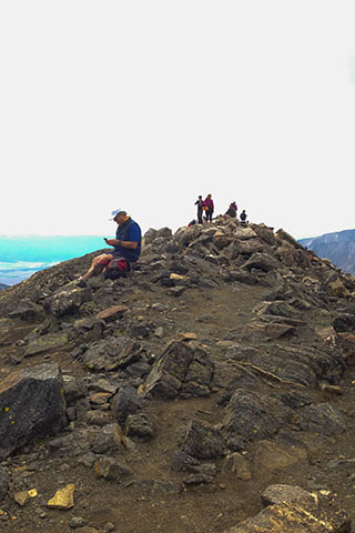
Nearing the Upper Slopes of Yale
A few Mount Yale Map notes ...
The map includes the Denny Creek Trail (also called Browns Pass Trail), Mount Yale Trail, and the Colorado Trail from Avalanche Trailhead to the East Ridge of Mount Yale.
If we can return and hike the East Ridge, we will add the route to the map. The East Ridge looks even better
The Mount Yale Trail is the standard Southwest Slopes Route.
We included the Colorado Trail but did not walk that section.
As always, agreeing on mileage is difficult. We had four GPS tracks. The tracks were very similar and it was easy to accept their readings. After taking out the extras (stops, etc) from the trackline we used the line's distance as mileage. The distance is in the range of the distance from other sources.
The Colorado Fourteeners Initiative has recently completed some amazing work on the Mount Yale Trail. A couple of sections of the trail were re-routed.
One of our favorite sections of the trail was not included in the re-route. We definitely can't complain, the new line is more sustainable for the volume of hikers, but we missed the special views.
The map includes the 0.25 mile markers on the trackline and mileage between waypoints. The markers make it easier for user to guesstimate the distance to waypoints or elevations.
The map was made with in the NAD 83 (1986) projection using NED data. The data is supposed to be more accurate.
Please check out the map and plan a hike!
Happy Mount Yale Map trails
Links
cloudhiking's Mount Yale Map