| 518 | Twin Sisters Trail Map and Guide |
2011-11-17 |

Since we started cloudhiking.com in 2009, we have been wanting to make Adventure Guides and Maps for the Rockies. We have been collecting data through the years and finally are pleased to say that we have completed our first map and guide to Twin Sisters Trail.
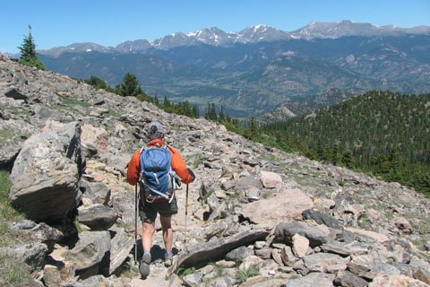
Twin Sisters Peak is a small mountain on the eastern edge of Rocky Mountain National Park. The trail travels over 3.5 miles from the trailhead at 9200 feet to the summit at just over 11,400 feet. The trail is rated as moderate; but that rating only applies to those who are fit and acclimated. For anyone visiting the area, it is a must do peak. We usually try to climb it each time we are in the area as an acclimating hike. The hike is a good measuring stick - when you reach the summit, you will know exactly how much more training you need to do before tackling loftier goals. Oh, and the views from the summits are incredible. We highly recommend the hike.
The Map and Adventure Guide to Twin Sisters Trail represents a milestone for us at cloudhiking and Metro to Mountain. We took the knowledge we learned by mapping trails in Tennessee and applied it to the Twin Sisters Trail. We are still learning; but we might figure it out one of these days. : )
By the way, for those who live in Tennessee or other areas of the South, we will continue to publish local maps and guides. A few of our goals are:
We just hiked Short Springs Natural Area and hope to work on the map soon
Visit other Tennessee State Natural Areas
Continue to visit the National Parks in our area.
Oh, and naturally, we are still planning to complete a few maps and guides for our favorite places in the West. In fact, we hope to be working on a map and guide to Longs Peak soon!
We love making maps and guides. We hope that they will inspire you to visit the areas, hike the trails, and climb the mountains. Thanks for joining us. Be sure to visit cloudhiking.com and check out the Twin Sisters pages.
Happy Twin Sisters trail