| 860 | Twin Sisters, Estes Cone Rocky Mountain National Park Map |
2013-09-23 |
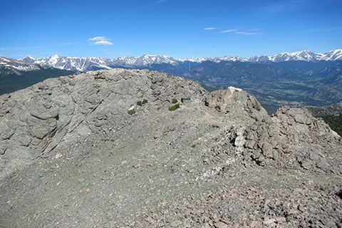
From the East Summit of Twin Sisters looking at the more popular West Summit
In 2011 we made our first map of Rocky Mountain National Park - it was of Twin Sisters. We now have made six total (Longs Peak, Hallett Peak, Mount Ida, Deer Mountain, Estes Cone, and Twin Sisters.) This summer (2013) we have been revising the maps and updating the cosmetics. It was odd that Estes Cone and Twin Sisters started from the same access area - Lily Lake, but we had made two different maps. With the new revision of Estes Cone and Twin Sisters maps, we combined them into a single map (and now we only have five maps!)
We celebrate the completion of every map. Even though the Twin Sisters - Estes Cone Map is just a revision - it is still important to us. Celebrate the moment and view the map! Thanks.
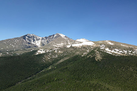
Longs Peak from Estes Cone
A few map notes ...
The map is completely new.
Included on the map are the Twin Sisters Trail, Storm Pass Trail (from Lily Lake Trailhead), Estes Cone Trail, Lily Lake Trail, Lily Ridge Trail, and parts of Eugenia Mine Trail (to Eugenia Mine but not to the junction with the East Longs Peak Trail.)
The background matches the shaded relief elevations we have used throughout the Park.
To aid in navigation, red dots are placed on the trail's tracking line at quarter of a mile intervals.
After completing the map, they are a couple of small corrections that need to be made on the Guides to Estes Cone and Twin Sisters. We will sync the map and guide as soon as possible.
Estes Park and the eastern section of Rocky Mountain National Park were hit hard by the flood of September 12-13 2013. We wish the best to all those in the area that lost so much. Amy (wife) found that our favorite coffee shop in Estes - Kind Coffee - was selling a special blend of coffee: "Flood Mud brewing for 1,000 years - Dam Good Coffee Supporting Flood Relief in Estes Park" Try it and help support the flood relief.
Happy Twin Sisters and Estes Cone trails