| 937 | Tundra Communities Trail aka - Toll Memorial Trail |
2014-06-23 |
We drove out to Colorado last Wednesday and Thursday (June 18&19) and continued to the west side of Rocky Mountain National Park. Our goal was to do a few hikes gathering data for cloudhiking and to get acclimated. For some reason the air in Tennessee seems a little thicker than the Colorado version.
After three good days of hiking and exploring we woke yesterday, the 22nd, to a rainy morning. Our plan was to walk a trail we had already walked before, so we decided to head east. It was time for us to play - Do You Want to be Tourist for a Day - and the answer was yes.
We packed up the tent, loaded up the car, and started the long drive over Trail Ridge Road. It was a fun drive because we were not in a hurry.
After stopping at the - not yet opened for the day - Alpine Visitor Center, we made our way to the Rock Cut, a couple of miles away.
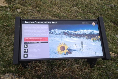
The Rock Cut is the trailhead for the Tundra Communities Trail, a pathway that leads a half of mile to the Toll Memorial. The paved walkway is lined with informational signage and placards about the tundra environment. I had previously visited the Park countless times and climbed Longs Peak 38 times, but I had never taken the time to walk out to the Roger Toll Memorial. Well, if we were tourist for the day, it was as good of a time as any to stretch our legs and lungs.
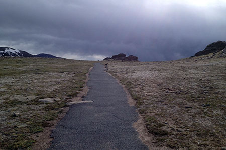
After an initial climb (that will get your heart pumping if you are not acclimated), the pathway rolls across the tundra to a few rock outcroppings.
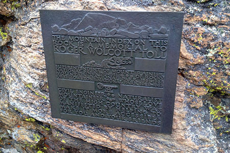
We crossed the tundra to the Memorial. Climbing the rocks on a well worn route we inspected the placard dedicated to Toll and then continued up to the peak finder.
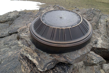
Visible peaks were identified on the circular sighting stand. It was great fun to settle arguments or start new ones. We tried to identify the Park's mountains and then checked ourselves with the peak finder.
After taking a few photographs, we started back, but stopped to read all of the informational signs.
We had a great walk. It took us about 45 minutes, but was worth the effort.
A few Tundra Communities Trail notes ...
The trail is at 12000 feet, high enough to bust a lung, or two. If you are not acclimated take it easy and breathe often.
Due to the high volume of users, signs remind all users to stay on the paved pathway and off the fragile tundra.
We were there at about 0845 on a Sunday morning. There was only one other person using the path while we were there.
The peak finder was great. It also showed the direction to other parks around America.
By reading the informational signs along the way, the was like a self guided nature trail.
Marmots were posing along the path.
It was a great short hike. We could not believe that we had not done it before.
Happy Tundra trails