| 848 | Timber Lake Rocky Mountain National Park |
2013-08-26 |
On Saturday, July 27, we were back in Estes Park, Colorado to finish our summer trip by completing a short list of hikes in Rocky Mountain National Park. We needed to visit Timber Lake on the west side of the Park, Hallett Peak from Bear Lake, and Longs Peak - because a summer is not complete without at least one ascent of Longs!
In May on cloudhiking.com, we completed the map of Mount Ida - the North Ridge Route from Milner Pass. Included on the map was the Timber Lake Trail. The only problem was, we had never hiked to Timber Lake. The trail data was taken from the Tiger files (census data that at times includes trails). To verify the track, we visually looked at a published trail map and it seemed as if they too used the Tiger files. Even though the data was probably accurate, we still needed to visit the area.
Earlier in the trip (when we originally planned the hike) the Timber Lake area was closed due to a wildfire. After the area re-opened, we were in Wyoming and had to postpone the hike to the end of the trip. Back in Estes, we finally were gong to be able to hike to Timber Lake.
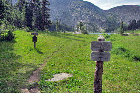
As we were camped on the east side of the Park, we woke early and made the hour (plus) drive to Timber Lake Trailhead. Soon we were on the trail. It was a few minutes after six.

Timber Creek
On the easy grade we adapted an even pace and still took the time to be distracted by anything that attracted our attention. The trail stayed high above Timber Creek until near the junction with the Long Meadows Trail. Above the junction, the trail was steeper and more scenic. There were great views of Timber Creek.
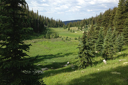
A High Meadow near the Jackstraw Sites
One of the highlights was a beautiful high meadow (or park) near the Jackstraw campsites and then Timber Lake.
Overall, it was a good walk. It was easy to see why it is so popular.
A few Timber Lake notes ...
The parking area was not busy at 6am.
The trailhead was much busier when we returned.
We saw no one on the trail on our hike to the lake.
There were quite a few parties on the trail around 11am.
In 2012 there had been a landslide that closed the Timber Lake Trail until the terrain was stable. The trail crosses the landslide debris.
There are 5 camping areas along the trail. Each backcountry site has it's advantages. None of the sites would be a bad choice for an overnight trip.
A privy is located almost next to the trail between the two Jackstraw camp sites.
Timber Lake is still in the trees.
We originally were going to climb Mount Ida from Timber Lake, but did not even attempt it. The trail to Timber Lake was not overly difficult, we just didn't feel like a long day.
Fishermen were at the lake.
We had expected the water of the lake to be clear, instead it was murky. We didn't know if that was normal, or not. The cloudy water could have been from recent rains, but it had not rained that much on the east side of the Park.

Timber Lake and the W Slope of Mount Ida
Back in Nashville with current trail data, yesterday, we finished the re-vised Mount Ida and Timber Lake Map on cloudhiking. (We hope to complete the guide to Timber Lake soon.) We corrected the errors on the original map and are happy with the revisions. Hope you enjoy it!
Timber Lake is a good destination for hiking, fishing, backpacking, and/or climbing Mount Ida.
Happy Timber Lake trails