| 834 | Tetons - Stewarts Draw | 2013-07-17 |
One of our goals for the summer was to climb Buck Mountain in the Tetons. After reading the peak description from the guidebook, it was a wonder to us why there was not a line of hikers climbing the peak every day. The flowering words gave the impression that the climb would be nothing more than a walk in the Park but, don't forget, we are in the Tetons.
We were unfamiliar with the approach to Buck Mountain, so we decided to spend a morning making sure we were acquainted with the route. Starting at Death Canyon Trailhead (in the southeast section of the Park) we started the GPS for the mileage to the trail cutoff. The route is an unmaintained trail off of a main trail meaning, there have been no improvements to the trail; not even a trail sign at the junction.
I was looking for the third bridge at about .75 mile from the trailhead but, after a short walk, Amy claimed we had reached the third bridge so the trail must be close by.
Checking my gps, I said no, we had only walked .48, not .75 miles.
We discussed it for a minute and Amy claimed that the mileage was supposed to be .50 mile instead. She still let me continue up the trail for a short distance further just to be sure. When we discussed the location of the trail again, I was still adamant that I had read it was .75 mile from the trailhead.
Amy located the photo of the approach route description she had taken that morning. Sure enough, it said .50 mile to the trail. We returned to the third bridge and found the trail.
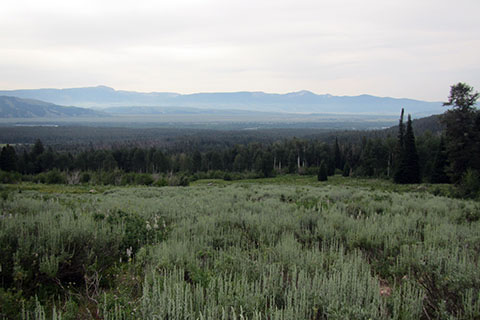
The trail led through a bit of downed trees (pine beetle damage) and into a meadow. We stopped and read and re-read the route description. The trail was supposed to go into the meadow and then disappear. The wording of the description seemed to be contradictory, but that was probably due to our unfamiliarity with the area. After pulling out a real map, we looked across the meadow and chose a path. If the trail we were on, took us in the general direction we wanted to go, then we would stay on the trail, and if not, then we would find a different path. Lots of other people had crossed the meadow so there should be some kind of path across it.
We headed up through the meadow on the path and basically, it went exactly where we wanted to go. The path was easy to follow, but the meadow brush was often times encroaching on the thin corridor. We were supposed to find a large cairn at a creek crossing, but that never happened. The path did lead us generally in a northwest direction to Stewarts Draw, our destination.
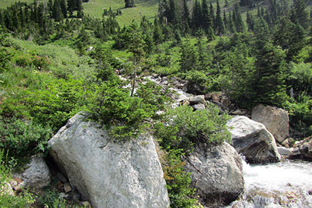
At a major creek crossing, we saw immediately that we were going to have to wade the chilly waters. I started across, but then decided it was going to be too deep. We decided to find another crossing upstream. The creek basically flowed from west to east. We stayed on the south side and followed an even smaller trail for about a quarter of a mile before we found a log crossing. On the other side of the creek, we found a trail that would probably connect with the main approach trail, but we had had enough. We were not used to the Teton steeps and the heat. We could have continued, but we had seen all that we needed to see to get the route.
A few trail notes ...
The Tetons have steep approaches. If we had done a familiar approach first, the path to Stewarts Draw would probably not have seemed as difficult.
About the mileage, on returning to the car we found the .50 miles to the trail in one description and .75 miles in another description, in the same book. It just goes to show you can never trust guides!
A trail or route guide are only tools. Never rely on the guide as a sole means of information. Use maps, compass, GPS, on line reports, etc - to supplement the guide description.
The meadow was very scenic.
We did not see any other hiker/climbers.
For this trip we decided not to climb Buck Mountain, but we were still happy with our morning in the meadow. Our main reason for not doing Buck, was there was still lots of snow on the route we wanted to do. The recon hike confirmed the route was not yet a rock scramble. We'll save it for another day.
Happy Stewarts Draw trails