| 694 | Summer Stories Misplaced |
2012-08-24 |
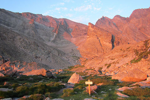
This summer ('12) Amy and I woke early one morning and hit the trail at about 4. Our destination was Mount Meeker with possibly a side trip to Longs Peak. Making good time, we passed the Chasm Lake Junction at 0530 and were at Chasm Meadows before 0600. We probably would have been there a bit quicker, but we had to deal with that morning alpenglow. For some reason we just had to keep stopping to take pictures!
Chasm Meadows was a planned stop. There is a great creek for filtering water and a privy nearby. What more could hikers ask for? As we ate a bit of food and drank the fresh mountain water, a lone hiker approached us.
The hiker was probably in his young twenties and fit. He stopped nearby.
Starting the conversation, I asked if he was going to do the Loft (our intended route). If he was going to do our route I was going to ask him if he wanted to climb with us. He would probably hike much faster than us, but maybe we would be able to keep up with him.
A puzzled look came over his face. After a moments pause he asked, was it the way to Longs Peak?
Well, sort of, it is the Loft Route, which climbs to the Loft (or saddle) between Meeker and Longs. From the Loft, you can climb the Clarks Arrow Route to get to Longs.
This isn't the Keyhole Route?
No, you went straight at the junction and you should have gone right.
Turning, he began to retrace his steps back to Chasm junction, a half mile away. He did not seem upset or concerned, he was just happy that he was now going the right direction.
Amy and I were talking about the misplaced hiker and I commented that at the Junction there was a trail sign but it directed hikers to the Boulderfield, not to the Keyhole Route or Longs Peak.
So lets fast forward ... last week there was a story of a rescue in Rocky Mountain National Park. Oh, we only assume that the hikers in the rescue were misplaced, you never know!
A couple of hikers on the trail in the early morning hours also took the wrong turn at Chasm Junction, or rather did not turn and also went to Chasm Meadows. At the Meadows, they continued on and climbed (scrambled) to Chasm Lake. Once at the Lake they hiked through the boulders and scree fields that form a maze on the east side of the lake. They then followed other (presumed) hikers up steep slopes to below the mighty East Face of Longs Peak. Not stopping there, the duo climbed the North Chimney, a somewhat (class 4 to 5.5) technical route. The chimney is generally considered to be the easiest approach to the famous Diamond, but it is still filled with loose, wet rock and with a steep snow or ice slope at it's base. Finally on Broadway Ledge, about 500 feet up, a Colorado Mountain School guide called the Park and requested assistance for the misplaced hikers. We guess they had had enough.
The great rescue staff of the Park, helped the pair off the mountain.
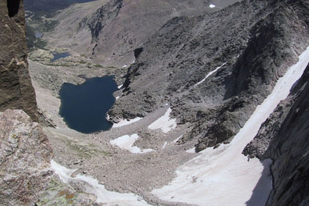
Chasm Lake
A few misplaced notes ...
We are not sure why the misplaced hikers went straight instead of turning at Chasm Junction. The incident seems oddly similar to our misplaced hiker.
At every junction, unless we are familiar with the trail, we stop and talk about the signage. Often times, we pull out the map to verify our decision.
If you don't want to carry a guide book with you, at least make notes. Amy makes great route cards.
Familiarize yourself with the intended route. For example, if you come to a lake that is not supposed to be there, you are probably going the wrong way. It might be time to look at a map.
Oh, carry a map. A compass is also important, but only if you have taken the time to learn the necessary skills.
Check with the route card during the hike. Do the routes match?
The internet is filled with info on hiking, scrambling, and climbing routes. Try 14ers.com, summitpost.org, mountainproject.com, and for hikes in TN (and some in CO) look at our site cloudhiking.com.
Don't be afraid to turn around.
Be safe.
Happy misplaced trails