| 958 | The Loop Rocky Mountain National Park (west) Map |
2014-10-15 |
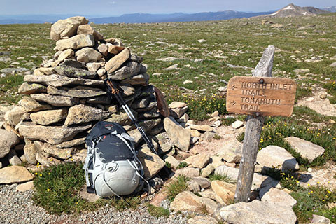
near the summit of Flattop Mtn,
the junction of North Inlet Trail and Tonahutu Trail
Over the summer ('14) we finally hiked the Loop in Rocky Mountain National Park. The Loop is on the west side of the Park. The route starts in the valley, travels one drainage to the alpine tundra and the Continental Divide and then returns to the valley by another drainage. The Loop is just over 25 miles long and is a very popular backpacking destination.
We had planned and made reservations for the hike twice, but had to change plans both times - once because of an injury and the other time due to a wildfire. When we finally hiked the route, we could easily see why it was so popular. The route is in such demand, a ranger told us that all of the camping sites were filled for the entire summer! Of course there is a small window of time when the area is snow free and thusly limiting hiking opportunities.
Naturally, we could not wait to make a map and guides.
The map took three weeks to make. Which is longer than normal, even for a large map. There were a couple of problems that just kept bugging us. Basically the USGS and all of the other maps (that we saw) had two drainages wrong. In other words the creeks were obviously in the wrong places. If we had not camped near each creek, we would probably never noticed the discrepancy. I am sure there are other errors, that we did not catch, but as always we try to be as accurate as possible.
Links
Our hike to North Inlet, Ptarmigan Mtn, Nanita Lake

North Inlet Trail
A few notes on the map discrepancies ...
Normally we use DEM (Digital Elevation Model) files for elevation data, but because of the misplaced creeks we used the NED (National Elevation Dataset) data instead for improved accuracy.
From the NED files we compiled the drainage lines for the map area and compared the lines to the Park's stream GIS files.
Next, we checked the stream and drainage lines versus the satellite images on iMap (the Apple Computer map app.) We used iMap instead of Google Map because there was less snow cover on the iMap image. The snow still on the ground in the iMap satellite image highlighted the creek.
It was easy to see the true line of the creeks in the satellite images, and therefore it was not necessary to load more orthographic imagery.
The two questionable drainage lines were Ptarmigan Creek (from Bench Lake to North Inlet) and Haynach Creek (from Haynach Lake to Tonahutu Creek.)
Last year we camped near Ptarmigan Creek and knew the creek and the designated campsite were close together. We went to the creek to view the falls and to collect water. Other maps show the creek as far as .15 miles to the west (where the creek crosses the North Inlet Trail).
This year we camped at Haynach Lakes designated sites. Other maps show Haynach Creek main drainage being crossed before reaching the campsite. An intermittent creek runs through the drainage where the unmaintained trail climbs. A side path leads west from the Haynach Lake Trail to the campsites. The campsites sit on the crest of a ridge like formation. The main creek is to the west of the campsites a short distance away.
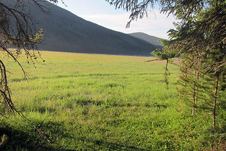
Big Meadows - Tonahutut Creek Trail
For a few other map notes ...
The map covers the North Inlet Trail, Lake Nanita Trail, Tonahutu Creek Trail, Haynach Lake (unimproved) Trail, Green Mountain Trail, Onahu Creek Trail and the KVC Spur Trail.
The map includes geographical features, trail track lines, .25 mile interval marks, campsites, mileages, trailheads, and more.
The North Inlet Trail seems more popular than the Tonahutu Creek Trail, but neither are as popular as the Bear Lake Trails on the east side.
A shorter loop is the Green Mountain Loop. The route starts at the Green Mountain Trailhead and follows the Onahu Creek Trail to the Tonahutu Trail and then takes the Green Mountain Trail to return to the Green Mountain Trailhead.
The Onahu Creek Trail was one of our favorites!
Much of the map area is wild. To safely travel through the area requires good outdoor skills.
The established trails on the map are easy to follow. The unmaintained trails and routes are at times trail-less.
We included the Northwest Ridge route on Ptarmigan Mountain and the West Slopes route on Hallett Peak.
As we complete more routes in the area, we will add them to the map.
There are 22 regular backcountry camping areas (some have multiple sites) on the map and 6 group sites.
The Loop was better than we expected. We had hiked from Bear Lake Flattop Mountain, over to Hallett Peak and then down Andrews Glacier - many times, but this was our first trip across the Big Horn Flats. It was amazing. Now, we definitely want to do the Milner Pass to Bear Lake route!
Please play with the map and put the Loop on the list for your next trip to the Park.
Happy The Loop trails