| 869 | Lawn Lake - RMNP Map and Guide |
2013-10-14 |

Over the weekend we completed cloudhiking.com's guide to Lawn Lake and map to the Mummy Range in Rocky Mountain National Park (RMNP site).
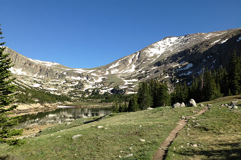
The Mummy Range is located in the northern section of Rocky Mountain National Park. Lawn Lake is the heart of the range surrounded by Fairchild Mountain, Hagues Peak, and Mummy Mountain.
The Lawn Lake Trail leaves the trailhead in Horseshoe Park near Hwy 34, Fall River Road. After a one mile climb, the trail levels out and follows the Roaring River to Lawn Lake. The banks of the Roaring River still show the signs of the 1982 flood. In the flood the earthen dam of Lawn Lake failed, sending a catastrophic flood down the Roaring River to Estes Park.
The Lake is a very popular destination for hikers, runners, and fishermen. The peaks above Lawn Lake offer a peakbagger many good adventures.
A few notes about the cloudhiking.com's map and guide ...
The guide includes directions, photos of the trail, a trail description, notes from our hikes, trail mileage, a link to the Mummy Range Map, and links to GPS tracklogs.
Lawn Lake Trail is 6.2 miles in distance and is rated as moderate. A 12.4 mile round trip is however a challenging day for most hikers.
Many hikers only hike to the overlook at about .40 mile from the trailhead or to the Roaring River Bridge on the Ypsilon Lake Trail- a little over 1.35 miles.
The first mile of the trail is probably the most difficult.
Above the first mile, the trail follows along the Roaring River. In general, the trail is at a moderate slope. Switchbacks help maintain the grade.
The lake seems to be a popular fishing destination. We are not fishermen.
At about 2.7 miles from the trailhead are two backcountry camping areas, Cutbank and Golden Banner. There are two campsites at Golden Banner.
At Lawn Lake are 4 campsites.
All campsites require a backcountry camping permit.
The trail continues beyond Lawn Lake and climbs to Crystal Lake and on to The Saddle (which is the saddle between Fairchild and Hagues).
Starting at the trailhead and climbing any of the neighboring peaks - Mummy, Hagues, or Fairchild - would be a good training climb to prepare for Longs Peak.
The Mummy Range map is large. At 1 to 9000 scale, it is over 40 inches wide.
The new map includes the Lawn Lake Trail, the trail to Crystal Lake and The Saddle, the Northeast Slope Route of Fairchild, the Southeast Slope Route of Mummy Mountain, the Ypsilon Lake Trail, the Spectacles Lake Route, the Mount Chapin Trail, North Slope of Mount Chapin Route, Southwest Slope of Chiquita Route, Southwest Slope of Ypsilon Route, and more! Note: routes do not follow maintained trails - they require navigational skills.
Old Fall River Road to Chapin Pass is also included on the map.
To aid in determining mileage, the trail's trackline includes a quarter of a mile markers on all of the trails.
The map and guide are free! But, please click on the links to our affiliates every now and then (daily if you'd like : - ) ) and think about us if you are going to buy anything from them. If you click our link first before buying, we get a very small stipend and it doesn't cost you anything! Thanks.
Enjoy the map and guide. By the way, the guide has great photos and is worth a visit to the pages just to dream.
Happy Lawn Lake Guide an Mummy Range Map trails