| 244 | Mount Kephart from Alum Cave Trailhead |
2010-06-21 |
To help us prepare for our up coming trip to the Rockies, we spent the weekend in the Smokies. We wanted to hike trails with at least 3,000 feet in elevation gain and a 6,000 feet summits. We chose Mount Kephart.
Mount Kephart is the seventh tallest peak in Tennessee at 6,217 feet. To climb Kephart and gain at least 3,000 feet we chose to hike the Alum Cave Trail to the top of Mount LeConte, then the Boulevard Trail to the Appalachian Trail, and then, hopefully, find a trail to the top of Kephart. The Appalachian Trail does not go to the summit of Kephart.
It had rained hard and long Friday night. We arrived at a wet trailhead at about 0615 central time. (Even though we were in the Eastern Time Zone, we will use Central Time.) The easy trail crosses a couple of creeks (Walker Camp Prong and Alum Cave Creek) on bridges and then strolls alongside the Alum Cave Creek for a mile.
The creek was very picturesque and seemed to be enjoyed by many hikers who did not want to venture far from the trailhead.
Arch Rock was the first significant landmark. It is important not just because of its uniqueness; but this is also where the trail begins to climb.
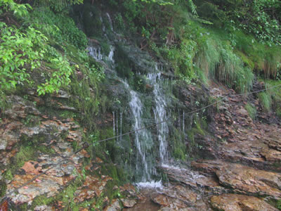
Steps leading to Alum Cave
Soon we were able to feel our muscles complaining as we pushed ourselves on the climb. Climbing LeConte was a lot of fun. The trail was unique and even challenging while wet. (I am not sure if it would ever be dry.)
In two hours we were filling our water bottles and using the facilities on top of LeConte. Cooling off from our climb, we had to put on our wind jackets to keep from getting chilled.
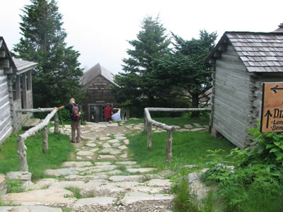
Mount LeConte Lodge
We had hiked five miles and climbed 2,500 feet. Kephart was still five miles away. We would take the Boulevard, that sounded easy enough.
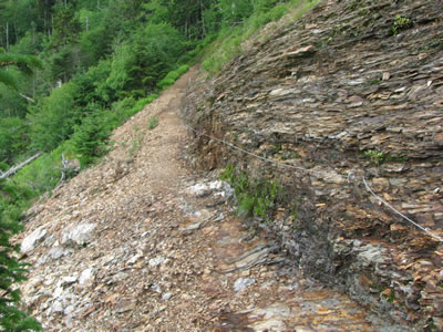
The Boulevard is not as hard as the Alum Cave Trail, but it still has its ups and downs. In fact the trail descends to 5500 feet before it decides to climb back to the Appalachian Trail.
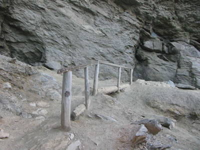
The rocky Boulevard
We really enjoyed the traverse. As we crossed we had not seen a soul after two miles. We noted that the only thing the Boulevard Trail needed was more people walking on it - to help with the encroaching vegetation. Soon our request came to fruition as we passed group after group of hikers heading to the Lodge! The trail was well used, the brush just grew fast.
Arriving at the Jumpoff Trail, we continued to the Appalachian Trail and turned north. Walked about a quarter of a mile until we saw that the trail was beginning to descend and then decided to try to find the summit of Kephart. We knew the general location of Kephart, we just did not see any trails going to the summit. The books we had with us just referred to Kephart as the AT crossed its shoulder. We needed to gain the top. We picked the least vegetated slope and started uphill. After climbing over 4,000 feet in elevation our legs felt the steepness. We were earning the right to stand on the summit as we encountered a briar patch near the top. We didn't discuss our situation we just continued.
Note: if we had stopped to discuss our plan, we may have quit. But, we were hoping to find a trail to hike down, once we reached the top. At times silence is golden.
Finally, still briar trampling, there were voices. I had a nice conversation with a man and his daughter while I stood on a log still eight feet from the trail in the midst of thick, six foot high brambles. The hikers did not seem to notice that I was floating on the sea of briars. They just continued on their merry way. Cursing, we continued to finally reach the luxury of the trail. Another hiker we met confirmed our suspicions, that we were on the Jumpoff Trail and on the summit of Mount Kephart.
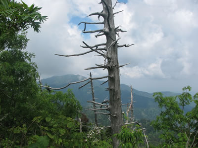
Mount LeConte from the summit of Mount Kephart
We were merely a few hundred feet of relative easy hiking back to the Boulevard Trail. We felt sick.
Now all we had to do was reverse our direction and head back over LeConte to the trailhead, 10.4 miles away.
As we dragged ourselves back to the car we were tired and ready to call it a day. We returned to the trailhead at 1710 (5:10 Central Time).
Doing the Alum Cave Trail and Boulevard Trail together gave us the big training day we were needing. The Topo Program (National Geographic) said our route was 21 miles and 6,800 feet of elevation gain. It was a big day.
Happy Kephart trails.