| 444 | Half Mountain | 2011-07-21 |
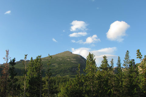
Heading north from Meeker Park, Colorado, a ridge of mountains dominate the eastern skyline of Rocky Mountain National Park. The ridge includes the massive Mount Meeker, the dominant Longs Peak (the highest in the Park), the famous Keyhole passage (of the Keyhole Route), Storm Peak (the mountain to the north of the Keyhole), and finally at the north end of the ridge, Half Mountain.
Often times I suppose that I saw Half Mountain but never gave it much thought. It was just on the end of the ridge of the more impressive Mount Meeker and Longs Peak. Then earlier on this trip, while camped at Glacier Basing Campground, I had a clear view of the ridge from Mount Meeker to Glacier Gorge Trailhead. Half Mountain seemed to live peacefully at the end of the ridge. Soon, I was searching for more information on Half Mountain from the guidebooks. None had much to say other than to follow an established trail to the base of the mountain and then head toward the summit. There were no trails, directional signs, or mileage markers leading to the summit. It sounded like a good adventure.
We left Glacier Gorge Trailhead around seven in the morning. Jon and Laura joined us for the hike. The two and a quarter mile hike to the base was straightforward. Soon we were looking at a trail-less slope wondering where to start. One place looked as good as the next so we built a small cairn on the established trail, marking our jump off point, and started climbing.
The climb grew continually steeper as we climbed. We found a faint trail to follow as we traveled through the pines. Once I turned and asked how steep the others thought the slope was, we decided it was probably 35 degrees. I have always overestimated the degrees of steepness so it must have really been 25 to 30 degrees. That was still steep.
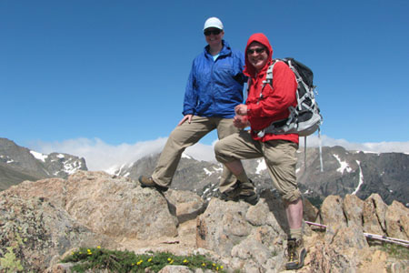
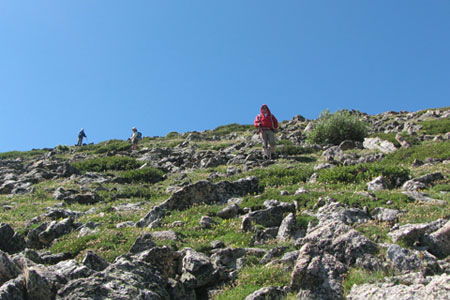
Above treeline we picked our way through fields of rocks (scree). The slope was unrelenting as we climbed higher. Then we clamored over the remaining rocks and stood on the summit. Wow! What a view. It was a very different reference point. We could see a bit of Mount Meeker and most of Glacier Gorge including Longs Peak, Pagoda, Chiefs Head, McHenry, and Thatchtop. It was a marvelous view.
After a short rest we started down the mountain; but decided not to follow our route of ascent. Instead, we followed the distinct East Ridge of Half Mountain. We all agreed that the angle of descent was less than the route we ascended.
It was a good, short distance hike but required route finding and steep off-trail climbing. It was aptly rated as a short - grade l and class 2 climb. You earn the right of the view.
A few Half Mountain trail notes ...
Half Mountain is located close to Glacier Gorge Trailhead in Rocky Mountain National Park.
The Glacier Gorge Trailhead has privies and a kiosk.
The small parking lot fills quickly during the summer months.
Follow the Alberta Falls Trail beyond the falls to the start of the North Longs Peak Trail. Turn onto the North Longs Peak Trail. Follow the trail across Glacier Creek and on for about a half mile. There are no trails or markers to indicate where to turn off the trail.
Look for the easiest path. The basic idea is to go up.
The route of travel is difficult. There is not a trail. Make sure you are prepared for the terrain.
Happy half a mountain trail.