| 950 | Mount Elbert Map and Trail Guide |
2014-08-27 |
View from Elbert's summit ridge
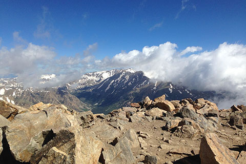
During the summer ('14), we re-climbed Mount Elbert. We had climbed the peak a couple of times before, but were still looking forward to the challenge. It was our first 14,000 feet peak of the summer so we hoped we were well acclimated.
From the North Mount Elbert Trailhead we took the North Elbert Trail up the Northeast Ridge, then descended from the summit via the South Elbert Trail down the East Ridge, and finally returned to the North Trailhead by hiking north on the Colorado Trail. The route was a good tour of Elbert.
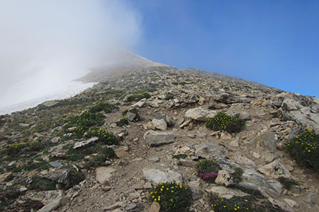
Mount Elbert is the highest of the Colorado Rockies. The standard routes of Elbert are not technically difficult, therefore you do not need a rope for the climb, but what you do need are lungs and legs. The Class 1 routes (North Mount Elbert Trail and South Mount Elbert Trail) climb to 14,433 feet (or the new adjusted NAVD 88 ortho height of 4401.2 (meters) or 14440 feet). The good trails all the way to the top cause the ranking of the peak to be classified as easy, but neophyte mountaineers will soon learn to respect the steepness of the slopes and the higher elevation of Mount Elbert (25 of Colorado's 14,000 feet peaks are less than 14,100 feet.)
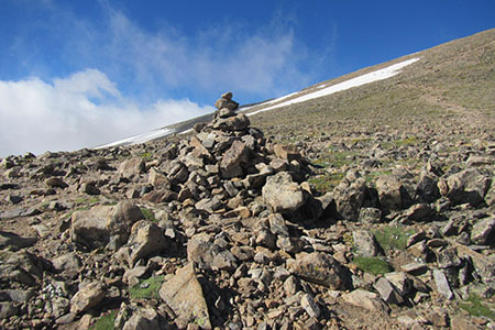
The Upper Ridge at 13,900', still 500+ feet to the summit!
The Mount Elbert Map and North Mount Elbert Trail Guide are now available on cloudhiking.com.
The map includes the North Mount Elbert Trail, South Mount Elbert Trail, and the connecting Colorado Trail.
The North Mount Elbert Trail Guide includes peak data, photographs of the route, route description, notes from our climbs, mileage, links to the maps, and user comments.
A few map and guide notes ...
The map includes waypoints and distances between the waypoints.
Distances may also be interpolated by using the 0.25 mile tick marks along the route.
The map is a good navigation tool. It is available in the geo-pdf and regular pdf forms. Any smart phone pdf reader app should be able to read the regular pdf map.
On our hike we quickly noticed that the Colorado Trail from the junction with the spur trail from the North Elbert Trailhead to the top of the ridge (0.85 mile) had been re-routed. We did not find the new track on any guide or map (we did not have the most current version of the maps, though.)
The mileage on our map and guide includes the re-routed trail.
The trail did not use marker blazes, but it was still easy to follow. The guide still helps the hiker become acquainted with the trail before their hike.
Jake (who died in MAY14) was the dog with Amy in the first photo on the cloudhiking page. Jake climbed 23 of the peaks in the summer of '09.
Lots of Mount Elbert climbing tips are included.
So please visit cloudhiking.com and check out the North Mount Elbert Trail guide and the Mount Elbert map. Thanks.
Happy Mount Elbert trails