| 980 | Deer Mountain Trail Map |
2015-03-02 |
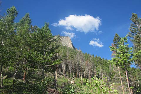
Deer Mountain - Deer Ridge Buttress
A couple of years ago, we (cloudhiking.com) made a map for Deer Mountain in Rocky Mountain National Park. The map featured the standard, three mile, Deer Mountain Trail (or West Deer Mountain Trail). The trail became one of our favorites for acclimating. The moderate slopes and relatively low elevation (10,013') helped us adjust to the mountain air.
Then a couple of years ago, while Amy was at a conference I spent a day exploring the southern Deer Mountain trails. Starting at Upper Beaver Meadows Trailhead, I crossed Deer Mountain and then returned to Upper Beaver Meadows using the South Deer Mountain Trail system.
Last summer (2014) we returned to explore the north side of the mountain. We thoroughly enjoyed our hike of the North Deer Mountain Trail. A map revision to include the Deer Mountain area (north and south) was put on the to do list.
A few Deer Mountain Trail notes ...
Deer Mountain is really just a bump just west of Estes Park, but it has great views of the central eastern section of the Park. From Deer it is easy to check on the snow conditions of the main (Park) peaks.
The map includes the Deer Mountain Trail (the standard), East Deer Mountain Trail, North Deer Mountain Trail, South Deer Mountain Trail, and many of the trails around Aspen Glen Campground and Upper Beaver Meadows.
The Deer Mountain Trail, East Deer Mountain Trail, and North Deer Mountain Trail include red, quarter mile markers on the trail lines. The red dots makes it easier to determine location and distances.
The South Deer Mountain Trail is not continuous from the East Deer Mountain Trail to Upper Beaver Meadows. The trail passes through the High Park residential area. There were a few times I had to scratch my head to find passage.
Aspen Glen Campground and the Fall River Entrance are to the north of Deer Mountain. The area also has a hodgepodge of trails that seem to be mostly used for guided horse rides. We always thought the North Deer Mountain Trail was also one of the heavily used horse trails, but it was not. The trail (except for the first .90 mile from the Deer Mountain Trail to the Aspen Glen Trail Jct) was a great hike with outstanding views.
The Loop crossing Deer Mountain and returning on the North Deer Mountain Trail was 10.60 miles.
The standard (West) Deer Mountain Trail is the only crowded section of the trail.
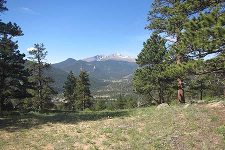
View of Longs from Deer Mountain
After exploring the rest of the mountain, Deer Mountain has been elevated in our list of favorite hikes. The North Loop option makes for a great hike.
Happy Deer Mountain trails
Links
Guide to the Deer Mountain Trail (new map is attached to the link)
Deer Mountain Trails - Trip Report