| 675 | Chapin, Chiquitta, Ypsilon |
2012-07-11 |

Following the Bear Burglary, we moved our camp to Aspen Glen Campground in Rocky Mountain National Park. In the meantime, we had visited REI in Boulder and stocked up on OpSacks - odor proof plastic bags with zip lock type closure. We stored all of our food in the bags. The campgrounds at Rocky Mountain National Park do not have bear boxes at each site like in the Tetons. It sure would make food storage easier, if they had the boxes ... We hoped the odor proof sacks would at least help.
With camp set up, we did laundry and prepared for our next hike. We were planning on hiking the trio - Chapin, Chiquitta, and Ypsilon (also known as the CCY - for their initials). Years ago we climbed Chapin with a group as an acclimating hike. It was fun and not very difficult. We planned and packed for a moderate day.
We left camp early and started the slow drive to the Chapin Pass Trailhead on Old Fall River Road. Once driving, the dirt road was a slow way to travel. It was very picturesque, though.
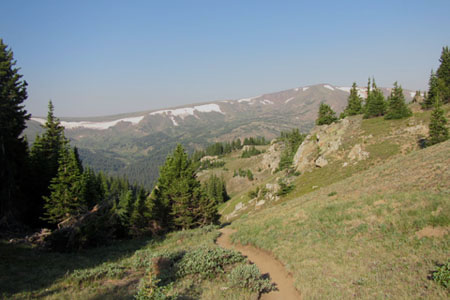
The hike began with a steep climb. If you are only climbing Mount Chapin, that might be the hardest climb of the hike. The climb leads to Chapin Pass. The trail heads east from Chapin Pass, but the junction is well signed.

The trail crosses the western slopes of Mount Chapin. You want to turn off the trail and start climbing, but it is best to resist the temptation. Finally, near the Chapin - Chiquitta Pass, a small trail leads to the summit of Chapin. The trail is a climber's trail and unimproved. but still is the easiest means of access. Once near the summit, try to find the highest piece of rock. We stood on a few points before we actually found what we thought was the summit.
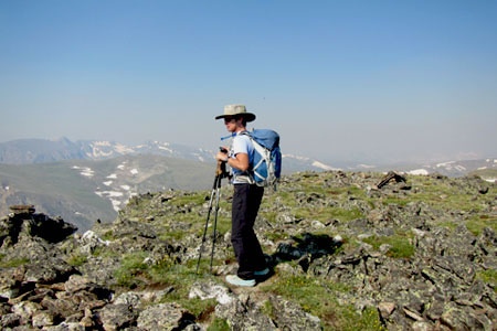
Returning to the Pass, we began the long climb up Chiquitta. The path soon disappeared and we followed rock cairns (rock towers) and a few footprints. The cairns might indicate a slightly easier path, but only slightly! The key to navigation is just to go up. Of course it is a good ways to the top!
A wind screen built from rocks was probably the highest point. We had great views from the summit. After a short rest we continued.

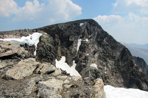
Still traveling northward, we descended a short distance to the Chiquitta - Ypsilon Pass and were soon climbing Ypsilon. Once again the way was only marked by cairns and the occasional boot-print. Staying close to the right side (east or southeast) there were great views. Near the top we were able to look down the two snow chutes that make the two arms of the Y on the east face of Ypsilon.
A short distance beyond and we were at the top.
Now for a few trail notes ...
The trio of peaks made a grand hike. Chiquitta was the longest climb of the three, but each slope seemed to be at about the same gradient. The views from each peak were a bit different.
You could hike to none of the peaks, instead just go to the Chapin-Chiquitta Pass, or you could hike to one, two, or all three of the peaks.
On returning, we did not go over the summit of Chiquitta (or Chapin). Instead we contoured around the western slope and even dropped down in elevation to finish at the Chiquitta Chapin Pass. The bypass was marked by occasional cairns.
Beware on the descent not to drop off into one of the neighboring valleys. If you go down too far, you will have to walk back up.
The off-trail travel requires a bit more navigation. The mountains do not have maintained trails. The climbs follow routes, not trails.
Watch out for afternoon storms.
The routes are very rocky - wear shoes for the occasion.
Happy Chapin, Chiquitta, Ypsilon trails (or routes!)