| 747 | Amphitheater Lake Map and Adventure Guide |
2012-12-24 |

Nestled in the northwest corner of Wyoming, the Tetons stand tall along the Idaho-Wyoming border. The relief is amazing. It is almost 7,000 feet difference in elevation from the peaceful shores of Jenny Lake and the lofty summit of the Grand (Teton). While visiting the Tetons, hikers soon realize the range is different from other Rocky Mountain ranges. The trails to even popular destinations require a lot of climbing - up!
The Amphitheater Lake (cloudhiking link) is a popular destination for hikers. The high mountain lake sits at 9700 feet on a shoulder of Grand Teton. Early mountaineers looking for an easy route to the summit of the Grand, passed Surprise and Amphitheater Lakes. Continuing above the lakes they found that the shoulder did not run continuously to the summit of Grand as hoped, instead it ended promptly at 11,618 feet on the summit of the aptly named Disappointment Peak.
The Amphitheater Lake Trail begins at the Lupine Meadows Trailhead. The well visited trailhead is located just south of the Jenny Lake complex. From the trailhead, the trail to Amphitheater Lake is divided into three sections: 1 - to the Valley Trail Junction, 2 - to the Garnet Canyon Junction, and 2 - to Surprise and then Amphitheater Lakes. All total, the trail is 4.8 miles - one way (9.6 miles round trip) and the trail climbs for 2,966 feet. The hike follows a well maintained trail with unforgeable views.

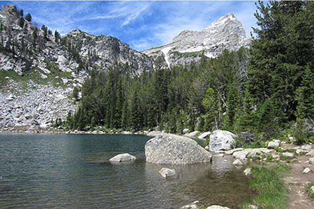
The View from Surprise Lake
A few Amphitheater Lake Trail notes ...
The hike is in Grand Teton National Park. The Park is a hiker's and climber's paradise. Please read and follow all of the Park's rules and safety guidelines.
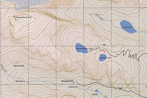
The map includes the trail to Surprise and Amphitheater Lakes, Garnet Canyon to the Platforms and boulderfield, Mount Teewinot to the Apex and a climber's route to the summit, and the small trail around the Moose Ponds.
The map includes grid lines and mileage on the map and on a chart in the legend.
The Adventure Guide includes 21 pictures and a trail description. The pictures were from a 2010 and 2012 visit.
The guide also includes detailed mileage data, notes from the hike, links to the map, and download-able GPS data.
Smart phone users may download the map to their phones as a pdf document.
If you have never hiked the trail, please go to the cloudhiking pages and dream. If you have hiked the trail, please go to the cloudhiking pages and remember the trail as you begin planning another visit!
Happy Amphitheater Lake trails
Amphitheater Lake Trail - cloudhiking pages