| 394 | Alum Cave Trail - Mount Le Conte |
2011-05-13 |
Last summer we climbed Mount Kephart by hiking the Alum Cave Trail to Mount Le Conte and then on to Kephart via the Boulevard Trail. Shortly after returning home we began working on the cloudhiking map and adventure guide for the trail. We never finished the guide to the trails. There were some unresolved issues.
No maps or guides are perfect. For example, from my house to the end of the street is .40 miles, as Google Maps measures the distance. If I carry a handheld GPS on the same route I could double the mileage by visiting neighbors, walking back and forth across the street, stopping to lend a hand, or just wandering. If I am not taking the absolute shortest path and with no stops, then the distances will differ. Creating a good map is more than just wandering with a gps. The map can only be as good as the data collected.
With all the waypoints, track logs and other data, I try to compile the information into a map, a visual guide. It is amazing how much I forget. I have learned tricks to help my memory; but sometimes I am just never happy with the results.
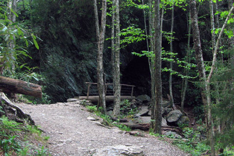
The Alum Cave Trail had one of those sections of trail on which I was never happy with our work. In the brand new Trails Illustrated Clingmans Dome/Cataloochee Map, as well as on the USGS topographic map, Arch Rock seemed to be in the wrong place; but how could that be? Not being an officially trained cartographer, I assumed it must have been something I was doing wrong...
For almost a year I wondered how I mapped Arch Rock in the wrong place. Then yesterday, I finally had the opportunity to re-walk the trail. Arch Rock is still where I thought it was and that location does not match the location on the USGS and Trails Illustrated maps.
We now hope to finish the map and guide to the Alum Cave and Boulevard Trails; but there are a few that we are currently finishing.
Back to the hike, a few notes ...
Alum Cave is a great hike.
I would highly recommend it to anyone who wanted a stiff trail.
The trail travels over lots of rocky sections with cables to protect the many exposed places along the trail.
There are no facilities at the trailhead.
The trail begins to climb steeply at Arch Rock. The trail to Arch Rock would be rated as easy with a few short moderate climbs and bridge crossings.
I met and passed a lot of hikers. For a Thursday, I though it was very busy.
It was very hot high, on the mountain.
There was a huge group of boys and their leaders coming up the path. The boys seemed to be doing fine; but the leaders were wanting to know, "how much farther is it?"
I also passed and then met a group of four hikers. The mom was moving very slowly; but she evidently really wanted to reach the top. They were above Alum Cave when I last saw them and they still had about 1.75 miles to go to the cabins. They seemed shocked by the distance remaining. Hopefully, they stuck with it and made it up and down safely. The mom was inspiring.
Remember, on any mountain, getting to the top is only the first half of the endeavor. Some hikers are slower going down than up (me, for example). Save energy for the return trip.
Happy I found Arch Rock trails