| 418 | Nashville Greenway | 2011-06-14 |

Sunday, my friend Jon and I rode the greenway from the Ted Rhodes Golf Course Club House to Percy Priest Dam and back.
Since last year, when I finished riding all of the pieces of the greenway, I have been wanting to ride the whole thing. I didn't even have to beg my friend, Jon, to join me - all I had to do was mention when I was going. Luckily for us it was almost a perfect weather day. There was a light breeze and it was a few degrees cooler than the heat of the previous days.
We considered riding from the house; but did not know how the downtown traffic would be due to the Country Music Association Festival. Instead, we drove to Shelby Bottoms Trailhead and started our ride from there. Since Shelby Bottoms was in the middle of the ride we would make two out and backs from the Trailhead. We first went toward town and the Metro Center. Once at the terminus at Freeland Station Trailhead, we found the path continued. Naturally we rode it. Though incomplete, the path was rideable. It continued for one mile to just beyond the Ted Rhodes Clubhouse.
Reversing our path we returned to the city and to Shelby Bottoms. After a mini-break for food and water, we continued toward Percy Priest Dam. The ride was enjoyable.
We returned to Shelby Bottoms at 2.30 in the afternoon. The total distance was about 41.40 miles.
It is amazing that Nashville has a path over twenty miles long. Okay, there is a small section from the Titans Stadium to Shelby Bottoms that is on the road; but that section has bike lanes. If you have the opportunity, give it a ride, walk, skate, or stroll, it is Nashville.
A few path notes ...
Two Rivers Park Trailhead has water. The water was close to the playground area. I assume there is water at the Shelby Bottoms Nature Center; but it did not seem to be open. Shelby Park probably has water in the picnic areas.
It is a long ride without water. Plan ahead.
Restrooms (or port-a-pottys) were at several locations.
Once again I assume there was a restroom at the Shelby Bottoms Nature Center; but it did not seem to be open.
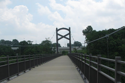
The path to Metro Center from Shelby Bottoms is easy except for crossing the bridge. It is a short but steep climb or descent.
Check your brakes before going down the steep hills and then control your speed. There are no run-a-way bike lanes!
Once across the Pedestrian Bridge make a U-turn and go to the river. Then, follow the river past Riverfront Park. Just beyond Fort Nashboro is the next trailhead and map kiosk.
The path maybe needs blazes or small directional signs as it travels over the sidewalks until it crosses 1st Ave North (just after the RR underpass). After crossing 1st, the path is obvious.
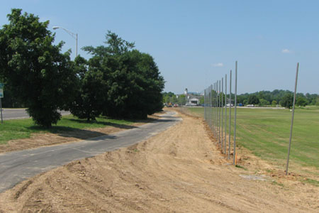
To our surprise at Fatherland Station the path did not end, but continued for another mile. The new section will have an overlook and trailhead.
Passing Ted Rhodes Golf Course, I almost got beaned with a golf ball. The fences are not up yet. Fore!
On our return to Shelby Bottoms, a section of 1st Avenue was closed because of the concerts. We talked the security man into letting us ride through.
Parking at Shelby Bottoms gave us a re-supply point. We only had to carry water and food for twenty miles at a time.
The Shelby Bottoms path is easy.
Two Rivers Park was bustling as we rode by.
Heartland has a soccer event, as usual.
Once the path joined Stones River Road, there was a path that ran parallel to the road for a very short distance, I could not see why.
The Kohl's to Percy Priest Dam section had received considerable flooding. The path was caked with mud and strewn with debris; but it was still passable.
Returning to Shelby Bottoms, there are three hills. The Heartland to the Middle School hill is the toughest.
There were many people riding, walking, and running on the path with us. Everyone was courteous and kind.
We passed the mighty General Jackson on our return to Shelby Bottoms.
It took us almost 5 hours to do the 41 miles at an easy pace.
Happy greenway trails

New section along Ted Rhodes Golf Course