| 224 | Five-Eight Loop | 2010-05-05 |
After the rainy weekend I finally got to record my walk of the "Five-Eight Loop" on the roadway at Percy Warner Park. The loop is popular with walkers. strollers, fitness walkers, runners, and bicyclists. I had not been on the roadway in years, and though I would rather hike the adjacent trails, many folks prefer the roads. The popularity is evident. The loop is a great walk.
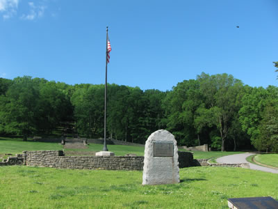
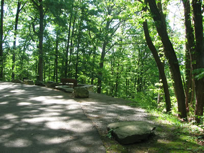
Starting at the Percy Warner Park Main Entrance at the end of Belle Meade Blvd, the road passes the golf course on the right as it heads to the trees. The rest of the road is mostly shaded until it returns to the parking area at the end of the loop. After a steady climb the road levels off at the first sharp curve. The first of several benches along the road is located on the inside curve.
Distances along the roadway are marked on New Balance mileage posts. It get a little confusing because at least three routes share the roadway. The Blue Route is the shortest as it goes left at the first intersection as it forms the Terrace View Drive. The Orange (or bright yellow) Route is the "Five-Eight Loop." The Green Route is the "Eleven-Two Loop".
Turning right at the first intersection follow the orange arrows. After a quarter of a mile the road climbs a steep hill. Ouch! It is one of the steeper hills, though short in distance.
The next mile or so covers easier ground. There are fewer ups and downs and lots of curves. At all road intersections follow signage for the "running routes" or the orange arrows.
At Deep Wells there is a port i-potty and a trail kiosk. The kiosk has a map posted for those curious of where they might be.
Continuing, the road goes through a couple of tight curves and then begins to climb Three Mile Hill. Don’t worry, the hill is not three miles long, instead it is located at about the three mile marker. It is a good climb.
At the top of the hill a major junction sends the Green Route to the right. The Orange (Five-Eight) Route goes to the left.
After staying up on the ridge through a couple of turns the road begins to descend. In .40 miles the Green Route rejoins the Orange Route. The Green Route is close to mile nine or near the top of Nine Mile HIll. At the top of the hill is a tight curve with a great overlook, a nice place to rest.
Curves and a few ups and downs brings the road to the junction with Lea’s Summit. To go out and view the overlook adds about .50 miles to the route.
After the junction the road descends sharply into a very tight hairpin curve. Continuing down the road goes through another sharp curve and then traverses to connect with the Blue Route. The Entrance is a half of mile further downhill.
A few trail notes...
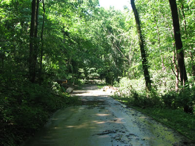
- We walked the road just following an epic rain storm. There was plenty of evidence as to the force of the storm.
- The Main Entrance (at the end of Belle Meade Blvd) has a water fountain but no other facilities. This is the only source of water on the entire route. You need to carry water with you or do without.
- Traffic on the roadway was at a minimum due to the downed trees. There were no signs posted indicating the temporary closures.
- There were many walkers and a few runners on the routes.
- Everyone wore ear buds.
- One car stopped to ask if there was a way for him to drive through the downed trees I was climbing through. I just said "not that I could see." But, of course, if I could have seen an easier way, I would not have been climbing through the maze of downed trees.
- All of the area Parks and Greenways have been hit hard by the flood. Don’t complain, volunteer to help.
Happy 5.8 trails.