| 967 | Summer Stories Finding Solitude |
2014-12-19 |

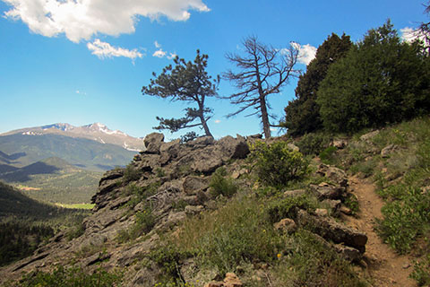
Longs Peak from eastern leg of Deer Mountain Trail
In the summer of '14, while staying in Rocky Mountain National Park, we hiked a few new (to us) trails. The trails were not commonly used, and the paths were not manicured like the more popular routes, making the experience greater.

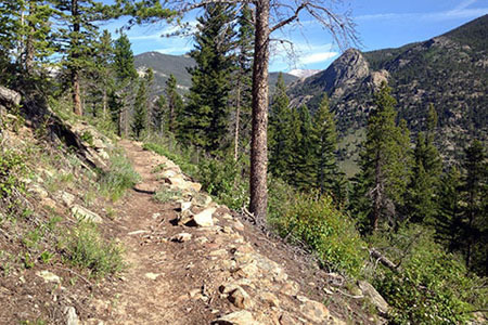
North Deer Mountain Trail
Deer Mountain
Through the years we have hiked the western leg of the Deer Mountain Trail many times. The trail is one of the better acclimating hikes for flatlanders and is very popular. Then last year, I finally walked the eastern leg of the Deer Mountain Trail. Once leaving the summit area, I was suddenly by myself. The trail was a fun alternative to the summit of Deer Mountain.
This year we returned to Deer Mountain to hike the Tour de Deer. Starting at Deer Ridge Junction, we followed well worn horse trails to the north side of the mountain and then continued around the mountain on the North Deer Mountain Trail. We had been afraid the the North Deer Mountain Trail was going to be a worn horse path, but to our delight it was not. Instead it was a very moderate, narrow track, contour around the north side of the mountain. We did not see anyone on the path and for that matter nor did we see any signs of anyone who had used the trail recently. We were absolutely alone. The trail ends on the east side of the mountain and we started climbing the eastern leg of the Deer Mountain Trail. The climb was as fun as the descent that I had made the previous year. As we made our way up the ridge we met a lone hiker. He was as shocked to see us as we were to see him.
A short time later we crossed the summit and descended the west side of the Deer Mountain Trail. The standard route was filled with hikers. The joys of hiking alone were suddenly interrupted by our choosing to hike a popular trail in prime time. As we walked we discussed our route and decided that we liked our route instead of the standard route and would always favor it over the norm.

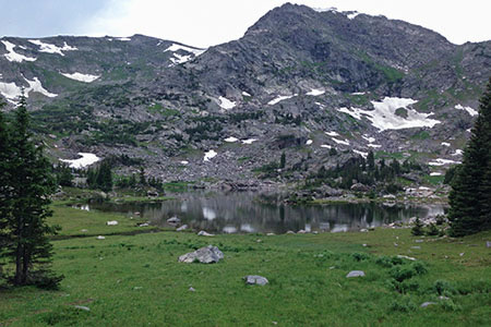
Haynach Lake
Haynach Lake
Later in the summer, we planned to hike the Rocky Mountain Loop. The route ascends the North Inlet and descends the Tonahutu Creek drainage. We reserved two backcountry campsites on the route. The second was at Haynach. When we picked up our permit, the ranger told us that the campsites were up a very steep path. It seemed as if the sites were used less frequently than others closer to the trail. We just smiled and said thank you.
The side trail to the campsites really was steep. It was not really challenging, but it did get our attention. After a short shower passed we set up camp and decided to hike to Haynach Lake. The campsites are not really close to the lake, but it was early in the afternoon, and a hike without a pack felt good.
Above the campsites the unmaintained side trail was less defined. After stopping to scratch our heads a couple of times and consulting the map, we found our way to the lake. It was breathtakingly beautiful. Standing near the shore we felt alone. Speaking loudly, we remarked about the beauty and solitude of the lake, set deep in the mountains, far away from the wide paths of the Park tourist.
As we captured the special moment, we noticed a figure across the lake. A young man who seemed to have been sunning while laying on the boulders of the opposite shore stood in our view. We had interrupted his tranquil experience. Oops. After a few more photos, we turned and left.
Haynach Lake was one of our favorite spots of the summer. Our only disappointment was that we did not spend enough time in the area (one night and then left the next morning before dawn.)
The quiet side of Deer Mountain and the distant Haynach Lake were two of our special memories of the summer but we had to chose the seldom used path to find the experience.
Happy Finding Solitude on the trails
Link to hike to Lake Solitude (Tetons)
Deer Mountain Map (we hope to update the map to include the entire North Deer Mountain Trail)
Haynach Lake Map (part of the Loop - Haynach Lake is to the north about in the center of the map)